Search Results
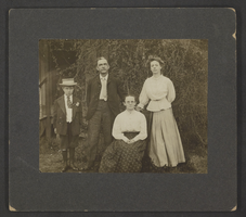
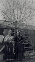
Photograph of George A. Clifton and others, Newton, Pennsylvania, circa 1900-1910
Date
1900 to 1910
Archival Collection
Description
George A. Clifton posing with Uncle George Clifton, Grandma Clifton, and Lillie Clifton in Newton, Pennsylvania.
Image
Photograph of Harold Stocker and mother Mayme Stocker, Reading, Pennsylvania, 1900
Date
1900
Archival Collection
Description
Black and white photograph of Mayme Stocker, 8 month old Harold Stocker, and an unidentified woman in Reading, Pennsylvania.
Image
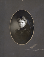
Photograph of Delphine Anderson Squires, circa late 1800s to early 1900s
Date
1890 to 1900
Archival Collection
Description
A portrait of Delphine "Della" Anderson Squires. Marceau Los Angeles is listed as the photograph's creator.
Image
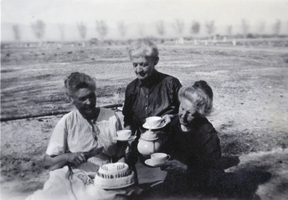
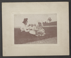
Photograph of Helen J. Stewart and two others outdoors, circa early 1900s
Date
1900 to 1926
Archival Collection
Description
Helen J. Stewart and two unidentified women with tea cups and a small cake, possibly at the Stewart Ranch in Las Vegas.
Image
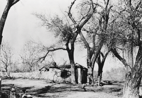
Photograph of the Las Vegas Ranch, Las Vegas, circa early 1900s
Date
1900 to 1950
Archival Collection
Description
The Las Vegas Ranch house and south wall of the Las Vegas Fort. Site Name: Las Vegas Ranch (Las Vegas, Nev.)
Image
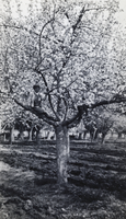
Photograph of a child in a tree at the Las Vegas Ranch, circa early 1900s
Date
1900 to 1950
Archival Collection
Description
A child standing on a branch of a tree in the Las Vegas Ranch orchard. Site Name: Las Vegas Ranch (Las Vegas, Nev.)
Image
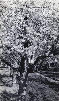
Photograph of children sitting in a tree, Las Vegas, circa early 1900s
Date
1900 to 1940
Archival Collection
Description
Two unidentified children sitting in a tree in the Las Vegas Ranch orchard. Site Name: Las Vegas Ranch (Las Vegas, Nev.)
Image
Film transparency of Helen J. Stewart and another woman, circa early 1900s
Date
1900 to 1920
Archival Collection
Description
Helen J. Stewart with an unidentified woman, probably in Las Vegas.
Image
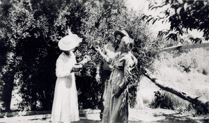
Film transparency of Helen J. Stewart and two others, circa early 1900s
Date
1900 to 1920
Archival Collection
Description
Helen J. Stewart with two unidentified people, probably in Las Vegas.
Image
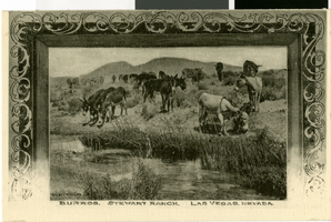
Postcard of donkeys drinking and grazing in Las Vegas, circa early 1900s
Date
1900 to 1930
Archival Collection
Description
Burros grazing near a stream at Stewart Ranch.
Image