Search the Special Collections and Archives Portal
Search Results
Las Vegas Valley Water District: "Comprehensive Annual Financial Report for the Fiscal Year Ended June 30, 2004", 2004 October 05
Level of Description
File
Archival Collection
Bruce Turner Collection on Transportation and Water in Southern Nevada
To request this item in person:
Collection Number: MS-00648
Collection Name: Bruce Turner Collection on Transportation and Water in Southern Nevada
Box/Folder: Box 12
Collection Name: Bruce Turner Collection on Transportation and Water in Southern Nevada
Box/Folder: Box 12
Archival Component
Las Vegas Valley Water District: "Comprehensive Annual Financial Report for the Fiscal Year Ended June 30, 2003", 2003 October 17
Level of Description
File
Archival Collection
Bruce Turner Collection on Transportation and Water in Southern Nevada
To request this item in person:
Collection Number: MS-00648
Collection Name: Bruce Turner Collection on Transportation and Water in Southern Nevada
Box/Folder: Box 12
Collection Name: Bruce Turner Collection on Transportation and Water in Southern Nevada
Box/Folder: Box 12
Archival Component
Las Vegas Valley Water District: "Comprehensive Annual Financial Report for the Fiscal Year Ended June 30, 2002", 2002 November 15
Level of Description
File
Archival Collection
Bruce Turner Collection on Transportation and Water in Southern Nevada
To request this item in person:
Collection Number: MS-00648
Collection Name: Bruce Turner Collection on Transportation and Water in Southern Nevada
Box/Folder: Box 12
Collection Name: Bruce Turner Collection on Transportation and Water in Southern Nevada
Box/Folder: Box 12
Archival Component
Campus life at 50 years photograph album, HRL scrapbook, 1995 Earth Day plaque from RHA students, approximately 1995 to 2018
Level of Description
File
Archival Collection
University of Nevada, Las Vegas Housing and Residential Life Records
To request this item in person:
Collection Number: UA-00105
Collection Name: University of Nevada, Las Vegas Housing and Residential Life Records
Box/Folder: Oversized Box 05
Collection Name: University of Nevada, Las Vegas Housing and Residential Life Records
Box/Folder: Oversized Box 05
Archival Component

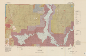
Topographic map of Lake Mead quadrangle, Nevada and Arizona, 1979
Date
1979
Description
'Edited and published by the Bureau of Land Management. Base map prepared by the U.S. Geological Survey.' 'Surface management status by BLM, 1981.Minerals management status by BLM, 1981.' Relief shown by contours and spot heights. Contour interval 50 meters. Compiled from USGS maps dated 1952-1970. Revised from aerial photographs taken 1972-73. Map edited 1979. Includes location map and index to 1:24,000 and 1:62,500-scale maps. Shows minerals owned by the federal government. 'N3600--W11400/30x60.' 'SE/4 Las Vegas (NJ 11-12) 1:250,000-scale map.' Scale 1:100,000
universal transverse Mercator proj. (W 115°00'--W 114°00'/N 36°30'--N 36°00'). Series: Surface-minerals management status. United States. Bureau of Land Management. Surface-minerals management status. Filing title: Lake Mead, Nev.--Ariz., 1979. Shows township and range lines. Published by United States, Dept. of the Interior, Bureau of Land Management
Denver, Colo. : For sale by U.S. Geological Survey,
Image
Moore, Wilisha C., "Workforce Diversity Programs: A Case Study of the Las Vegas Valley Water District's "3-year Diversity Implementation Plan"", 2002 Spring
Level of Description
Item
Archival Collection
University of Nevada, Las Vegas Theses, Dissertations, and Honors Papers
To request this item in person:
Collection Number: UA-00082
Collection Name: University of Nevada, Las Vegas Theses, Dissertations, and Honors Papers
Box/Folder: Box 358
Collection Name: University of Nevada, Las Vegas Theses, Dissertations, and Honors Papers
Box/Folder: Box 358
Archival Component

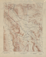
Topographic map of the Furnace Creek quadrangle, Nevada and California, 1947
Date
1947
Description
'E.M. Douglas, geographer. R.H. Chapman, in charge of section. Topography by R.H. Chapman, B.D. Stewart, J.E. Blackburn and D.F.C. Moor. Traingulation by R.H. Chapman and D.F.C. Moor. Surveyed in1905-1906.' 'Edition of Apr. 1910, reprinted 1947.' Scale 1:250,000 ; polyconic proj. (W 117°00´--W 116°00´/N 37°00´--N 36°00´). Relief shown by contours and spot heights. 'North American datum.' 'Contour interval 100 feet.' 'Datum is mean sea level.' Text and illustrations from the Topographic maps of the United States series on verso. Series: The topograhic maps of the United States. United States, Dept. of the Interior, Geological Survey
Text
#71363: John Guedry, Lee Business School alumni of the year honoree photographed for Alumni Awards Dinner on February 8, 2017, 2017 February 08
Level of Description
Item
Archival Collection
University of Nevada, Las Vegas Creative Services Records (2010s)
To request this item in person:
Collection Number: PH-00388-05
Collection Name: University of Nevada, Las Vegas Creative Services Records (2010s)
Box/Folder: Digital File 01
Collection Name: University of Nevada, Las Vegas Creative Services Records (2010s)
Box/Folder: Digital File 01
Archival Component
#71639: Michael Frazier, third-place winner of 2017 President's Classifed Employee of the Year Award on July 13, 2017, 2017 July 13
Level of Description
Item
Archival Collection
University of Nevada, Las Vegas Creative Services Records (2010s)
To request this item in person:
Collection Number: PH-00388-05
Collection Name: University of Nevada, Las Vegas Creative Services Records (2010s)
Box/Folder: Digital File 01
Collection Name: University of Nevada, Las Vegas Creative Services Records (2010s)
Box/Folder: Digital File 01
Archival Component
Pagination
Refine my results
Content Type
Creator or Contributor
Subject
Archival Collection
Digital Project
Resource Type
Year
Material Type
Place
Language
Records Classification
