Search the Special Collections and Archives Portal
Search Results
Freck Lydon, husband of Catherine Banovich-Lydon and Jack Dempsey at Tonopah's 50th Year Celebration, 1950
Level of Description
File
Archival Collection
Nye County, Nevada Photograph Collection
To request this item in person:
Collection Number: PH-00221
Collection Name: Nye County, Nevada Photograph Collection
Box/Folder: Folder 29
Collection Name: Nye County, Nevada Photograph Collection
Box/Folder: Folder 29
Archival Component
Parker-Davis Project, Western Area Power Administration 10 year plan, and site inspections, 1992-1995
Level of Description
File
Archival Collection
Colorado River Commission of Nevada Reference Library Collection
To request this item in person:
Collection Number: MS-00427
Collection Name: Colorado River Commission of Nevada Reference Library Collection
Box/Folder: Box 02
Collection Name: Colorado River Commission of Nevada Reference Library Collection
Box/Folder: Box 02
Archival Component
#66334: McDonough, Ann (Dr) with First Year Student Focus Group for Inside UNLV, 2008 May 01
Level of Description
File
Archival Collection
University of Nevada, Las Vegas Creative Services Records (2000s)
To request this item in person:
Collection Number: PH-00388-04
Collection Name: University of Nevada, Las Vegas Creative Services Records (2000s)
Box/Folder: N/A
Collection Name: University of Nevada, Las Vegas Creative Services Records (2000s)
Box/Folder: N/A
Archival Component
Anderson, Russell Edwin,"A Model for Implementing an Optimized Casino Degreen Curriculum within the Two-Year College", 1983
Level of Description
Item
Archival Collection
University of Nevada, Las Vegas Theses, Dissertations, and Honors Papers
To request this item in person:
Collection Number: UA-00082
Collection Name: University of Nevada, Las Vegas Theses, Dissertations, and Honors Papers
Box/Folder: Box 246
Collection Name: University of Nevada, Las Vegas Theses, Dissertations, and Honors Papers
Box/Folder: Box 246
Archival Component
Lewin, Elyse. We Built it - You'll Love it! The Design House of the Year, House Beautiful, 1979 May
Level of Description
File
Archival Collection
UNLV Libraries Collection of Articles on Gaming and Las Vegas, Nevada Topics
To request this item in person:
Collection Number: MS-00626
Collection Name: UNLV Libraries Collection of Articles on Gaming and Las Vegas, Nevada Topics
Box/Folder: Box 15
Collection Name: UNLV Libraries Collection of Articles on Gaming and Las Vegas, Nevada Topics
Box/Folder: Box 15
Archival Component
Steidel, Kenneth Harold, "Time management behaviors of single parent women educators at a two-year college", 1993
Level of Description
Item
Archival Collection
University of Nevada, Las Vegas Theses, Dissertations, and Honors Papers
To request this item in person:
Collection Number: UA-00082
Collection Name: University of Nevada, Las Vegas Theses, Dissertations, and Honors Papers
Box/Folder: Box 271
Collection Name: University of Nevada, Las Vegas Theses, Dissertations, and Honors Papers
Box/Folder: Box 271
Archival Component

Bancroft's map of California, Nevada, Utah and Arizona, 1873
Date
1873
Description
Hand colored ; Relief shown by hachures and spot heights ; Prime meridian: Washington, D.C ; Shows railroads, proposed railroads and wagon roads, etc. Published by A.L. Bancroft & Company. Scale [ca. 1:1,520,640]. 1 in. to 24 miles (W 124°--W 111°/N 42°--N 32°).
Image

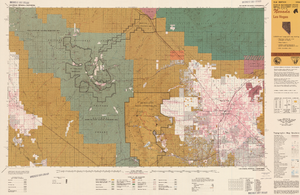
Map of Las Vegas, Nevada and surrounding Bureau of Land Management areas to the west and north, 1994
Date
1994
Description
'BLM edition, 1994.' 'Surface management status; mineral management status.' '1:100,000-scale topographic map showing highways, roads and other manmade structures; water features; contours and elevations in meters with conversions to feet; BLM recreation sites.' 'Edited and published by the Bureau of Land Management. Base map prepared by the U.S. Geological Survey.' I53:11/4-2
Text
#68878: UNLV Homecoming College Alumnus of the Year awards are presented by Alumni Association President Sandra Phillips Johnson November 2, 2012 at the University of Nevada, Las Vegas, 2012 November 02
Level of Description
File
Archival Collection
University of Nevada, Las Vegas Creative Services Records (2010s)
To request this item in person:
Collection Number: PH-00388-05
Collection Name: University of Nevada, Las Vegas Creative Services Records (2010s)
Box/Folder: Digital File 00
Collection Name: University of Nevada, Las Vegas Creative Services Records (2010s)
Box/Folder: Digital File 00
Archival Component

Margaret Covelli, chief nursing officer at Spring Valley Hospital and Medical Center is the School of Nursing Alumni of the Year. August 11, 2015: digital photographs
Date
2015-08-11
Archival Collection
Description
Photographs from the University of Nevada, Las Vegas Creative Services Records (2010s) (PH-00388-05).
Image
Pagination
Refine my results
Content Type
Creator or Contributor
Subject
Archival Collection
Digital Project
Resource Type
Year
Material Type
Place
Language
Records Classification
