Search the Special Collections and Archives Portal
Search Results
Nevada Mining Photograph Collection
Identifier
Abstract
The Nevada Mining Photograph Collection depicts mining activities, miners, and mining towns in Nevada from 1868 to 1937. The photographs primarily depict the towns of Tonopah, Nevada and Goldfield, Nevada, including mills, buildings, mine shafts, and panoramic views of the landscape. The photographs also depict Beatty, Lost City, Delamar, Candelaria, Winnemucca, Virginia City, Rhyolite, Elko, and Reno, Nevada. The photographs also include portraits of early settlers in Nevada, Native Americans, children, parades, celebrations, and funerals.
Archival Collection
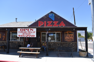
Old Nevada Pizza wall mounted signs, Hawthorne, Nevada
Date
Archival Collection
Description
The wall mounted signs for Old Nevada Pizza during the day.
497 E St, Hawthorne, NV 89415
Old Nevada Pizza
Image
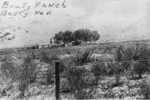
Beatty Ranch, Beatty, Nevada: photographic print
Date
Archival Collection
Description
From the Nye County, Nevada Photograph Collection (PH-00221) -- Series III. Beatty, Nevada -- Subseries III.H. Miscellaneous
Image
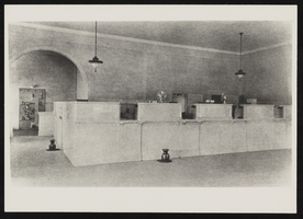
Interior view of First State Bank, Las Vegas, Nevada: photographic print
Date
Archival Collection
Description
Image

View of Las Vegas, Nevada: photographic print
Date
Archival Collection
Description
Image
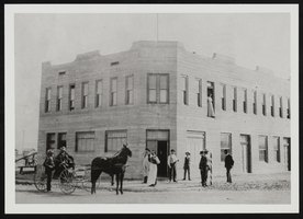
Hotel Nevada, Las Vegas, Nevada: photographic print
Date
Archival Collection
Description
Image
Progressive Leadership Alliance of Nevada Records
Identifier
Abstract
The Progressive Leadership Alliance of Nevada (PLAN) records span the years 1994 to 2002 and are comprised of material documenting the organization's involvment in gay issues in Las Vegas, Nevada. PLAN was founded in 1994 as the umbrella organization for Nevada's progressive groups and institutions. This collection is comprised of material documenting the Minority Status and Child Protection Act of 1994 and the Coalition for Unity and Equal Rights Nevada, and contains a number of files from that effort, including opinion surveys, meeting agendas and campaign plans.
Archival Collection
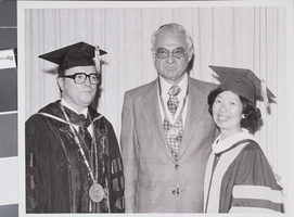
Photograph of commencement for the University of Nevada, Las Vegas, 1978
Date
Archival Collection
Description
Description provided with image: "1.) Dr. Brock Dixon; 2) Artemus Ham, Jr.; 3) Lilly Fong, regent. Commencement 1978."
Image
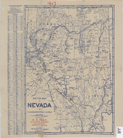
Sketch map of Nevada and the southeastern portion of California, 1906
Date
Description
Image

