Search Results
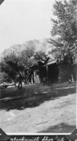
Film transparency of blacksmith shop at Wilson's Ranch, Las Vegas, circa early 1900s
Date
Archival Collection
Description
Image

Film transparency of Jack Naylor at Wilson's Ranch, Las Vegas, circa early 1900s
Date
Archival Collection
Description
Image
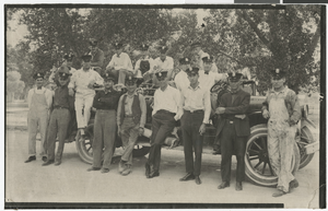
Photograph of the Las Vegas Volunteer Fire Department, Las Vegas, early to mid 1900s
Date
Archival Collection
Description
A group photo of the Las Vegas Volunteer Fire Department in Las Vegas, Nevada. Description provided with image: "Back row, sitting on truck: Ray Nealy, Jimmie Downs, Shorty DeBrink, Harry Jameson, Henry Kampling. Stand of back step: Roy Neagle (Nagley?). Standing: Bill Trelease, RER (Earl Rockwell), Gene Parks, Leon R. (Rockwell), Harold Case, Horace Taylor, Jimmy Adams, Percy Scholenberger (Shellenberger?), Tom Lake. Driver seat: Archie Mellot, Al Conger."
Image
Huntington Lake, Santa Susanne, Tappo Alto, Pisga, Hayfield, and Daggett, California: photographic negatives and annotated envelopes, 1925 to 1940
Level of Description
Archival Collection
Collection Name: Frank D. Rathbun Photograph Collection
Box/Folder: Folder 131
Archival Component
Gold mine east of Las Vegas, Nevada, unidentified man and woman, William Beckley, Leva Beckley, unidentified man, and Jake Beckley (identified left to right on verso): photographic print, approximately 1915 to 1925
Level of Description
Archival Collection
Collection Name: Beckley Family Photograph Collection
Box/Folder: Folder 02
Archival Component
Las Vegas High School girls during a physical education class: photographic print and photographic negative, approximately 1925 to 1929
Level of Description
Archival Collection
Collection Name: K. O. Knudson Photograph Collection
Box/Folder: Folder 01, Box SH-021
Archival Component
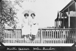
Film transparency of Martha Kramer and Helen Bunker, presumably in Las Vegas, circa early 1900s
Date
Archival Collection
Description
Image
Portrait of Noah Dietrich, Chief Executive Officer of the Howard Hughes Corporation from 1925-1957, approximately 1940-1959
Level of Description
Archival Collection
Collection Name: Howard Hughes Professional and Aeronautical Photographs
Box/Folder: Folder 16
Archival Component

Photograph of James Squires's house in Austin, Minnesota, circa late 1800s to early 1900s
Date
Archival Collection
Description
Image
Photograph of Art, Alta Ham, Lucille, and Ernie Cragin, circa early to mid 1900s
Date
Archival Collection
Description
Image