Search Results
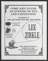
Aid for AIDS of Nevada raffle flyer
Date
Archival Collection
Description
Text

General highway base map, state of Nevada, 1975
Date
Description
Image
State of Nevada Educational Directories, Bulletins, and Certification Requirements
Identifier
Abstract
The State of Nevada Educational Directories, Bulletins, and Certification Requirements (1934-1991) contain bi-monthly bulletins, yearly directories, information to certify teachers, and retirement salaries.
Archival Collection
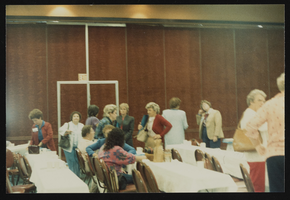
Nevada Nurses Association conference in Las Vegas, Nevada: photographic print
Date
Archival Collection
Description
Image
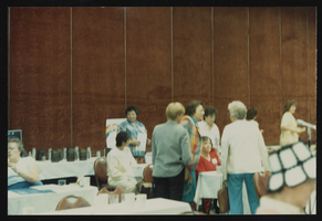
Nevada Nurses Association conference in Las Vegas, Nevada: photographic print
Date
Archival Collection
Description
Image

Bank of Nevada located in Las Vegas, Nevada: photographic print
Date
Archival Collection
Description
Image
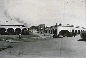
Slide of Nevada Highway, Boulder City, Nevada, December 1, 1931
Date
Archival Collection
Description
Image
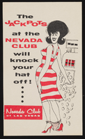
Nevada Club: postcards
Date
Archival Collection
Description
Image
Nevada Wildlife Federation Records
Identifier
Abstract
The Nevada Wildlife Federation Records (1989-1997) consist of pamphlets, newsletters, periodic meeting minutes, and a copy of the bylaws of the Nevada Wildlife Federation.
Archival Collection
Nevada State Board of Education Teacher and Student Exams
Identifier
Abstract
The Nevada State Board of Education Teacher and Student Exams (1894, 1927-1931) consists of a 1894 testing booklet from the Nevada State Board of Education containing questions to test the knowledge of teachers. The test includes subjects such as physiology, reading, orthography, geography, and United States history. The collection also contains Nevada Elementary Examination sheets from 1927 to 1931, intended to test students on a variety of subjects including arithmetic, spelling, civics, penmanship, reading and grammar, and United States history.
Archival Collection