Search Results
First Nevada Southern University Commencement, Las Vegas, Nevada, 1964 June 03
Level of Description
File
Archival Collection
University of Nevada, Las Vegas Photograph Collection
To request this item in person:
Collection Number: PH-00062
Collection Name: University of Nevada, Las Vegas Photograph Collection
Box/Folder: Folder 8
Collection Name: University of Nevada, Las Vegas Photograph Collection
Box/Folder: Folder 8
Archival Component
Unknown author. Lucky for you, there's Laughlin, Nevada, Nevada Hospitality 10(1), 1991
Level of Description
File
Archival Collection
UNLV Libraries Collection of Articles on Gaming and Las Vegas, Nevada Topics
To request this item in person:
Collection Number: MS-00626
Collection Name: UNLV Libraries Collection of Articles on Gaming and Las Vegas, Nevada Topics
Box/Folder: Box 16
Collection Name: UNLV Libraries Collection of Articles on Gaming and Las Vegas, Nevada Topics
Box/Folder: Box 16
Archival Component
Shaffer, Wayne A. Control of Gaming in Nevada: a Look at Licensing, Nevada Gaming Licensing, 1980
Level of Description
File
Archival Collection
UNLV Libraries Collection of Articles on Gaming and Las Vegas, Nevada Topics
To request this item in person:
Collection Number: MS-00626
Collection Name: UNLV Libraries Collection of Articles on Gaming and Las Vegas, Nevada Topics
Box/Folder: Box 15
Collection Name: UNLV Libraries Collection of Articles on Gaming and Las Vegas, Nevada Topics
Box/Folder: Box 15
Archival Component
LVLWC Las Vegas, Nevada - proposed municipal ownership of water and power systems at Las Vegas, Nevada (1 of 2)
Date
1934 to 1950
Archival Collection
Description
Series 2. Las Vegas Land and Water Company -- General Manager, Manager of Properties, and Manager of Industrial Development in Los Angeles, California -- Industrial Development Subject Files
Mixed Content
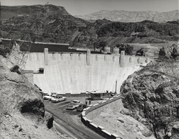
Film transparency of Hoover Dam, Nevada, 1961
Date
1961
Archival Collection
Description
Hoover Dam near Boulder City, Nevada, 1961.
Image
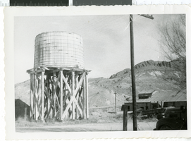
Photograph of a water tower in Beatty, Nevada, 1956
Date
1956
Archival Collection
Description
A picture of Tonopah and Tidewater water tower at Beatty, Nevada.
Image
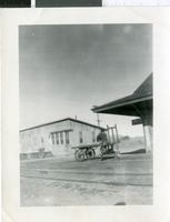
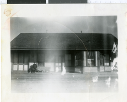
Photograph of railroad station in Goldfield, Nevada, 1956
Date
1956
Archival Collection
Description
Tentatively identified as Tonopah & Goldfield Station in Goldfield, Nevada.
Image
Photograph of railroad station in Goldfield, Nevada, 1956
Date
1956
Archival Collection
Description
Tentatively identified as Tonopah & Goldfield Station in Goldfield, Nevada.
Image
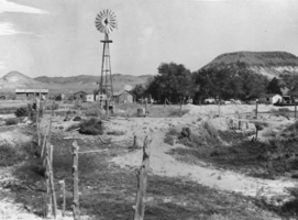
View of the Twin Springs, Nevada: photographic print
Date
1950 to 1953
Archival Collection
Description
From the Nye County, Nevada Photograph Collection (PH-00221) -- Series VII. Other areas in Nye County -- Subseries VII.C. Fallini Family (Twin Springs, Nevada)
Image