Search Results

A drawing of the MGM Grand Hotel in Reno, Nevada: postcard
Date
1940 (year approximate) to 1990 (year approximate)
Archival Collection
Description
From the Harvey's Hotel and Casino Postcard Collection (PH-00367) -- A drawing of the MGM Grand Hotel in Reno, Nevada.
Image
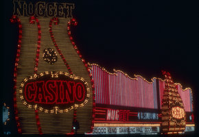
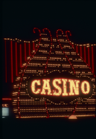
Slide of the Nugget Casino, Carson City, Nevada, circa 1980s
Date
1980 to 1989
Archival Collection
Description
A color image of the animated neon signs for the Nugget Casino, located in Carson City, Nevada, illuminated at night.
Image
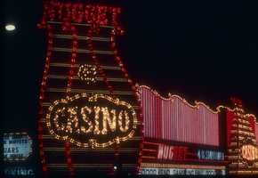
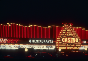
Slide of the Nugget Casino, Carson City, Nevada, circa 1980s
Date
1986
Archival Collection
Description
A color image of the animated neon signs for the Nugget Casino, located in Carson City, Nevada, illuminated at night.
Image

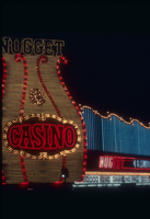
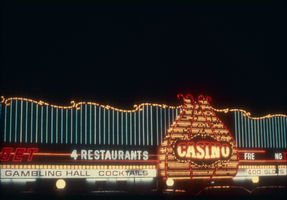
Slide of the Nugget Casino, Carson City, Nevada, circa 1980s
Date
1986
Archival Collection
Description
A color image of the animated neon signs for the Nugget Casino, located in Carson City, Nevada, illuminated at night.
Image
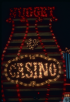
Slide of the Nugget Casino, Carson City, Nevada, circa 1980s
Date
1986
Archival Collection
Description
A color image of the animated neon signs for the Nugget Casino, located in Carson City, Nevada, illuminated at night.
Image
Slide of the Nugget Casino, Carson City, Nevada, circa 1980s
Date
1986
Archival Collection
Description
A color image of the animated neon signs for the Nugget Casino, located in Carson City, Nevada, illuminated at night.
Image
Slide of the Nugget Casino, Carson City, Nevada, circa 1980s
Date
1986
Archival Collection
Description
A color image of the animated neon signs for the Nugget Casino, located in Carson City, Nevada, illuminated at night.
Image
Slide of the Nugget Casino, Carson City, Nevada, circa 1980s
Date
1986
Archival Collection
Description
A color image of the animated neon signs for the Nugget Casino, located in Carson City, Nevada, illuminated at night.
Image
Slide of the Nugget Casino, Carson City, Nevada, circa 1980s
Date
1986
Archival Collection
Description
A color image of the animated neon signs for the Nugget Casino, located in Carson City, Nevada, illuminated at night.
Image
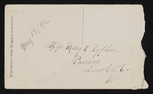
Letter and envelope from John M. Bunker, Eldorado Canyon, Nevada to Mary Etta Syphus, Panaca, Nevada
Date
1892-05-17
Archival Collection
Description
From the Syphus-Bunker Papers (MS-00169). The folder contains an original handwritten letter, a typed transcription of the same letter, the original envelope with the stamp removed, and a copy of the original letter.
Text