Search Results
Hughes Aircraft Company Weapons System Publications
Identifier
Abstract
The Hughes Aircraft Company Weapons System Publications (approximately 1965-2011) contain brochures, booklets, photographs, and illustrations of the AWG-9/Phoenix Air Superiority Weapon Control System developed by Hughes Aircraft Company Aerospace Systems Division based in California. The collection contains photographs of various aircraft, as well as a Supersonic Naval Ordnance Research Track (SNORT) test at the Naval Ordnance Test Station near China Lake, California.
Archival Collection
Sahara Boardwalk, Atlantic City, New Jersey, 1980; 1980 July 14
Level of Description
Archival Collection
Collection Name: Martin Stern Architectural Records
Box/Folder: N/A
Archival Component

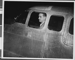
Photograph of Howard Hughes, Los Angeles, September 11, 1946
Date
Archival Collection
Description
Image

Map of economical features of parts of southern Colorado and northern New Mexico, January 8, 1878
Date
Description
37 x 49 cm. Relief shown by hachures and spot heights. "Atlas sheet no. 69(B)." "Issued Jan'y 8th 1878." "Expeditions of 1874-1875 & 1877 under the command of 1st. Lieut. Geo. M. Wheeler, Corps of Engineers, U.S. Army." Prime meridians: Greenwich and Washington, D.C. "Weyss, Lang & Herman, del." "By order of the honorable the Secretary of War." "Under the direction of Brig. General A. A. Hunphreys, Chief of Engineers, U. S. Army." Original publisher: U.S. Geographical Surveys West of the 100th Meridian, Scale: 1 inch to 4 miles or 1: 253440.
Image
Howard Hughes in the back seat of a car en route to his hotel in New York, 1936 July 14
Level of Description
Archival Collection
Collection Name: Howard Hughes Professional and Aeronautical Photographs
Box/Folder: Folder 04
Archival Component
Howard Hughes riding on back of car in a parade marking the New York World's Fair, approximately 1939-1940
Level of Description
Archival Collection
Collection Name: Howard Hughes Professional and Aeronautical Photographs
Box/Folder: Folder 07
Archival Component
Howard Hughes giving a news conference beside his airplane after landing in New York, 1947 April
Level of Description
Archival Collection
Collection Name: Howard Hughes Professional and Aeronautical Photographs
Box/Folder: Folder 02
Archival Component
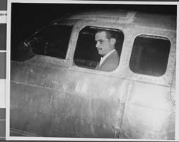
Photograph of Howard Hughes, Los Angeles, September 11, 1946
Date
Archival Collection
Description
Image
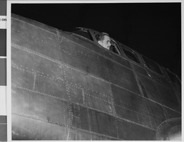
Photograph of Howard Hughes, Los Angeles, September 11, 1946
Date
Archival Collection
Description
Image
Photograph of Howard Hughes, Los Angeles, September 11, 1946
Date
Archival Collection
Description
Image