Search the Special Collections and Archives Portal
Search Results
Hughes H-1 Racer photographs, 1937
Level of Description
Scope and Contents
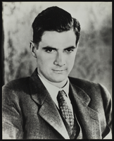
Materials depict the Hughes H-1 Racer in 1937. The photographs primarily depict Howard Hughes standing with the plane or in the plane's cockpit. The plane was designed by Glenn Odekirk and built by Hughes Aircraft Company in 1935, the first plane produced by the company. Hughes broke several records in the H-1, including the landplane speed record in 1935. In 1937, Hughes broke his own transcontinental speed record by flying from Los Angeles, California to New York City, New York in 7 hours, 28 minutes. Despite its speed, Hughes was unable to sell the H-1 to the U.S. military.
Archival Collection
Collection Name: Howard Hughes Public Relations Photograph Collection
Box/Folder: N/A
Archival Component

Publicity photographs of Howard Hughes and Hughes aircraft and clippings about technical drawings of Hughes aircraft: photograph album
Date
Archival Collection
Description
Mixed Content

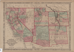
Map of California, Utah, Nevada, Colorado, New Mexico and Arizona, circa 1867
Date
Description
Image
The New Superstar Commune: Las Vegas, Cavalier, 1975 July 24
Level of Description
Archival Collection
Collection Name: Arnold Shaw Papers
Box/Folder: Box 14
Archival Component
#65212: New Student Union Building, Exteriors, 2006 July 05
Level of Description
Archival Collection
Collection Name: University of Nevada, Las Vegas Creative Services Records (2000s)
Box/Folder: N/A
Archival Component
#65755: New Student Recreation Center - Exteriors, 2007 July 11
Level of Description
Archival Collection
Collection Name: University of Nevada, Las Vegas Creative Services Records (2000s)
Box/Folder: N/A
Archival Component
#65756: New Student Union Building - Exterior, 2007 July 11
Level of Description
Archival Collection
Collection Name: University of Nevada, Las Vegas Creative Services Records (2000s)
Box/Folder: N/A
Archival Component
#64785: New Student Union - Start of Construction, 2005 July 08
Level of Description
Archival Collection
Collection Name: University of Nevada, Las Vegas Creative Services Records (2000s)
Box/Folder: N/A
Archival Component
Construction on the new cafeteria at Basic Magnesium Incorportated, 1943 July 31
Level of Description
Archival Collection
Collection Name: Henderson Public Library Photograph Collection on Henderson, Nevada
Box/Folder: Folder 05
Archival Component
#66471: Marchand, Gwen - New Faces Article, 2008 July 23
Level of Description
Archival Collection
Collection Name: University of Nevada, Las Vegas Creative Services Records (2000s)
Box/Folder: N/A
Archival Component
