Search Results

Photograph of a flight path map, July 1938
Date
Archival Collection
Description
Description printed on back of photograph: "Close up of map and miniature plane attached showing Hughes' flight to date. 7/38"
Image
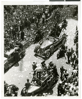
Photograph of a parade procession, New York, July 15, 1938
Date
Archival Collection
Description
Image
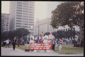
Photographs of March to Los Angeles: City Hall, Culinary Union, Los Angeles (Calif.), 1992 (folder 1 of 2)
Date
Archival Collection
Description
Arrangement note: Series I. Demonstrations, Subseries I.B. Other Demonstrations and Strikes
Image
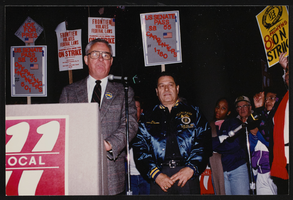
Photographs of March to Los Angeles: City Hall, Culinary Union, Los Angeles (Calif.), 1992 (folder 2 of 2)
Date
Archival Collection
Description
Arrangement note: Series I. Demonstrations, Subseries I.B. Other Demonstrations and Strikes
Image
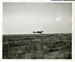
Photograph of the Lockheed 14, July 10, 1938
Date
Archival Collection
Description
Image
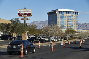
Sign for the North Vista Hospital Medical Center with City Hall in background, looking north in North Las Vegas, Nevada: digital photograph
Date
Archival Collection
Description
From the UNLV University Libraries Photographs of the Development of the Las Vegas Valley, Nevada (PH-00394). Part of the collection documents the entire 19 mile length of the north/south Eastern Avenue / Civic Center Drive alignment. This photograph was captured in the section of Civic Center Drive between Las Vegas Boulevard and Lake Mead Boulevard.
Image

Photograph of a parade procession, New York, July 15, 1938
Date
Archival Collection
Description
Image
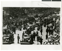
Photograph of a parade procession, New York, July 15, 1938
Date
Archival Collection
Description
Image
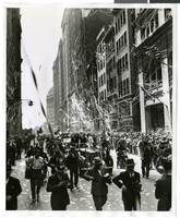
Photograph of a parade procession, New York, July 15, 1938
Date
Archival Collection
Description
Image
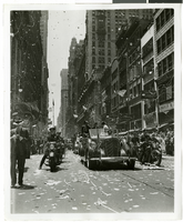
Photograph of a parade procession, New York, July 15, 1938
Date
Archival Collection
Description
Image