Search Results
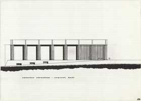
Architectural drawing of concert hall, Nevada Southern University, Las Vegas, Nevada, exterior elevation, 1968
Date
Archival Collection
Description
South exterior elevation of concert hall (later named Artemus W. Ham Concert Hall) at Nevada Southern University, Las Vegas, Nevada (later the University of Nevada, Las Vegas).
Site Name: Nevada Southern University
Address: 4505 S. Maryland Parkway
Image

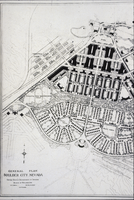
Aerial photograph of Boulder City (Nev.), circa 1933
Date
Archival Collection
Description
Image
Photograph of a document for the Boulder City 31ers, Image 2, Boulder City (Nev.), April 11, 1987
Date
Description
Text
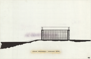
Architectural drawing of concert hall, Nevada Southern University, Las Vegas, Nevada, court elevation, 1968
Date
Archival Collection
Description
Court (east) elevation of concert hall (later named Artemus W. Ham Concert Hall) at Nevada Southern University, Las Vegas, Nevada (later the University of Nevada, Las Vegas).
Site Name: Nevada Southern University
Address: 4505 S. Maryland Parkway
Image
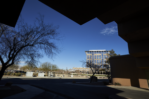
An exterior view of the North Las Vegas City Hall framed by the roofline of a medical office building on North McDaniel Street in North Las Vegas, Nevada: digital photograph
Date
Archival Collection
Description
From the UNLV University Libraries Photographs of the Development of the Las Vegas Valley, Nevada (PH-00394). Part of the collection documents the entire 19 mile length of the north/south Eastern Avenue / Civic Center Drive alignment. This photograph was captured in the section of Civic Center Drive between Las Vegas Boulevard and Lake Mead Boulevard.
Image
Slide of an architectural drawing of Boulder City, Nevada, March 5, 1931
Date
Archival Collection
Description
Image
Kansas City Rotary Club miscellaneous information, Kansas City, Kansas, 1962
Level of Description
Archival Collection
Collection Name: Charles J. Hirsch Papers
Box/Folder: Box 03
Archival Component
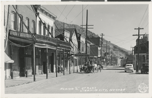
Postcard of C Street in Virginia City, Nevada, 1859 to late 1800s
Date
Archival Collection
Description
Image