Search the Special Collections and Archives Portal
Search Results
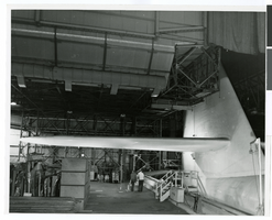
Photograph of the interior of an airplane hangar at the Hughes Helicopters Division of Summa Corporation, Culver City, California, circa late 1950s
Date
Archival Collection
Description
Image
Hughes H-1 Racer photographs, 1937
Level of Description
Scope and Contents
Materials depict the Hughes H-1 Racer in 1937. The photographs primarily depict Howard Hughes standing with the plane or in the plane's cockpit. The plane was designed by Glenn Odekirk and built by Hughes Aircraft Company in 1935, the first plane produced by the company. Hughes broke several records in the H-1, including the landplane speed record in 1935. In 1937, Hughes broke his own transcontinental speed record by flying from Los Angeles, California to New York City, New York in 7 hours, 28 minutes. Despite its speed, Hughes was unable to sell the H-1 to the U.S. military.
Archival Collection
Collection Name: Howard Hughes Public Relations Photograph Collection
Box/Folder: N/A
Archival Component
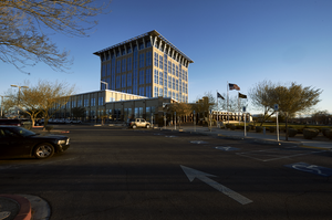
Exterior view of the North Las Vegas City Hall building, looking northeast in North Las Vegas, Nevada: digital photograph
Date
Archival Collection
Description
From the UNLV University Libraries Photographs of the Development of the Las Vegas Valley, Nevada (PH-00394). Part of the collection documents the entire 19 mile length of the north/south Eastern Avenue / Civic Center Drive alignment. This photograph was captured in the section of Civic Center Drive between Las Vegas Boulevard and Lake Mead Boulevard.
Image
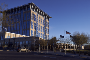

Exterior view of the North Las Vegas City Hall campus, looking northeast in North Las Vegas, Nevada: digital photograph
Date
Archival Collection
Description
From the UNLV University Libraries Photographs of the Development of the Las Vegas Valley, Nevada (PH-00394). Part of the collection documents the entire 19 mile length of the north/south Eastern Avenue / Civic Center Drive alignment. This photograph was captured in the section of Civic Center Drive between Las Vegas Boulevard and Lake Mead Boulevard.
Image
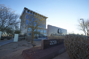
Exterior view of the North Las Vegas City Hall building, looking east in North Las Vegas, Nevada: digital photograph
Date
Archival Collection
Description
From the UNLV University Libraries Photographs of the Development of the Las Vegas Valley, Nevada (PH-00394). Part of the collection documents the entire 19 mile length of the north/south Eastern Avenue / Civic Center Drive alignment. This photograph was captured in the section of Civic Center Drive between Las Vegas Boulevard and Lake Mead Boulevard.
Image
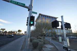
Exterior view of the North Las Vegas City Hall building, looking east in North Las Vegas, Nevada: digital photograph
Date
Archival Collection
Description
From the UNLV University Libraries Photographs of the Development of the Las Vegas Valley, Nevada (PH-00394). Part of the collection documents the entire 19 mile length of the north/south Eastern Avenue / Civic Center Drive alignment. This photograph was captured in the section of Civic Center Drive between Las Vegas Boulevard and Lake Mead Boulevard.
Image
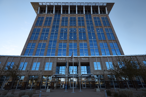
Exterior view of the North Las Vegas City Hall building, looking southeast in North Las Vegas, Nevada: digital photograph
Date
Archival Collection
Description
From the UNLV University Libraries Photographs of the Development of the Las Vegas Valley, Nevada (PH-00394). Part of the collection documents the entire 19 mile length of the north/south Eastern Avenue / Civic Center Drive alignment. This photograph was captured in the section of Civic Center Drive between Las Vegas Boulevard and Lake Mead Boulevard.
Image
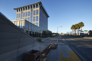
Exterior view of the North Las Vegas City Hall building, looking west in North Las Vegas, Nevada: digital photograph
Date
Archival Collection
Description
From the UNLV University Libraries Photographs of the Development of the Las Vegas Valley, Nevada (PH-00394). Part of the collection documents the entire 19 mile length of the north/south Eastern Avenue / Civic Center Drive alignment. This photograph was captured in the section of Civic Center Drive between Las Vegas Boulevard and Lake Mead Boulevard.
Image
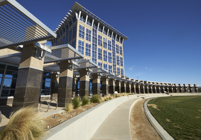
Exterior view of the North Las Vegas City Hall building, looking northeast in North Las Vegas, Nevada: digital photograph
Date
Archival Collection
Description
From the UNLV University Libraries Photographs of the Development of the Las Vegas Valley, Nevada (PH-00394). Part of the collection documents the entire 19 mile length of the north/south Eastern Avenue / Civic Center Drive alignment. This photograph was captured in the section of Civic Center Drive between Las Vegas Boulevard and Lake Mead Boulevard.
Image
