Search the Special Collections and Archives Portal
Search Results
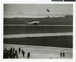
Photograph of the landing of Howard Hughes' Lockheed 14 aircraft, New York, July 14, 1938
Date
1938-07-14
Archival Collection
Description
The black and white, aerial view of Howard Hughes' Lockheed 14 aircraft performing its final landing on the Round the World flight at Floyd Bennett Airport, New York.
Image
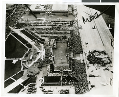
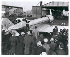
Photograph of Howard Hughes leaving the Northrop Gamma Racer, Newark, New Jersey, January 13, 1936
Date
1936-01-13
Archival Collection
Description
Howard Hughes leaving the cockpit of a Northrop Gamma, surrounded by a crowd at Newark New Jersey Airport. Hughes set a coast-to-coast speed record. A bank of microphones and a movie camera are seen beside the plane.
Image
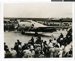
Photograph of the landing of Howard Hughes' Lockheed 14 aircraft, New York, July 14, 1938
Date
1938-07-14
Archival Collection
Description
The black and white view of Howard Hughes' Lockheed 14 aircraft performing its final landing on the Round the World flight at Floyd Bennett Airport, New York. Typed onto a piece of paper attached to the image: "Howard Hughes taxiing up runway at Floyd Bennett Airport."
Image

Photograph of Howard Hughes and Grover Whalen at Floyd Bennett Airfield, New York, July 14, 1938
Date
1938-07-14
Archival Collection
Description
A view of Howard Hughes and Grover Whalen at Floyd Bennett Airfield in New York. Description printed on photograph's accompanying sheet of paper: "Howard Hughes leaving Floyd Bennett Airport after completing a round the world flight with four companions. He is leaving with Grover Whalen (Left in picture) 7-14-38. (Press Association)."
Image
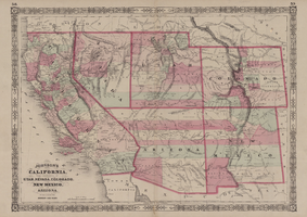
Map of California, with territories of Utah, Nevada, Colorado, New Mexico, and Arizona, 1864
Date
1864
Description
40 x 62 cm. Relief shown by hachures. Prime meridians: Greenwich and Washington. Page numbers at top: 58-59. "Entered according to act of Congress in the year 1864 by A. J. Johnson in the Clerk's Office of the District Court of the United States for the Southern District of New York." Original publisher: Johnson and Ward.
Image

Photograph of the landing of Howard Hughes' Lockheed 14 aircraft, New York, July 14, 1938
Date
1938-07-14
Archival Collection
Description
The black and white, aerial view of Howard Hughes' Lockheed 14 aircraft preparing for its final landing on its Round the World flight in Floyd Bennett Field, New York.
Image

Photograph of the landing of Howard Hughes' Lockheed 14 aircraft, New York, July 14, 1938
Date
1938-07-14
Archival Collection
Description
The black and white, aerial view of Howard Hughes' Lockheed 14 aircraft after performing its final landing on the Round the World flight at Floyd Bennett Airport, New York.
Image
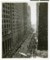
Photograph of a parade procession, New York, July 15, 1938
Date
1938-07-15
Archival Collection
Description
An overhead view of people looking up and waving during a parade procession.
Image
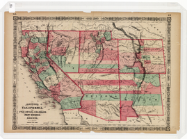
Map of California, Utah, Nevada, Colorado, New Mexico and Arizona, 1864
Date
1864
Description
'Johnson's California, with Utah, Nevada, Colorado, New Mexico, and Arizona, published by Johnson and Ward.' 'Entered according to Act of Congress in the Year 1864 by A.J. Johnson in the Clerks Office of the District Court of the United States for the southern district of New York.' Atlas page numbers in upper margin: 66-67. This is probably plate 67 from Johnson's New Illustrated Family Atlas, published in New York by Johnson & Ward in 1864. Shows natural features, locations of Indian tribes, proposed railroad routes, routes of explorers, trails, county boundaries and populated places ; "." ; Relief shown by hachures ; Prime meridians: Greenwich and Washington ; In top margin: 66-67 ; Hand colored ; On verso: Historical and statistical view of Mexico and central America (p. 79) and Historical and statistical view of the United States, 1860 (p. 78) Scale [ca. 1:3,484,800]. 1 in. to ca. 55 miles (W 124°--W 102°/N 42°--N 32°)
Text
Pagination
Refine my results
Content Type
Creator or Contributor
Subject
Archival Collection
Digital Project
Resource Type
Year
Material Type
Place
Language
Records Classification
