Search Results
Crowd at Floyd Bennett Airfield, New York, 1938 July 14
Level of Description
File
Archival Collection
Howard Hughes Public Relations Photograph Collection
To request this item in person:
Collection Number: PH-00373
Collection Name: Howard Hughes Public Relations Photograph Collection
Box/Folder: Folder 09
Collection Name: Howard Hughes Public Relations Photograph Collection
Box/Folder: Folder 09
Archival Component

Menu for dinner to James R. Pardy given by Mr. G. C. Howard, June 13, 1895, at Café Royal
Date
1895-06-13
Archival Collection
Description
Menu insert: Wine lists Restaurant: Café Royal Location: 68 Regent Street, W., London, England
Text
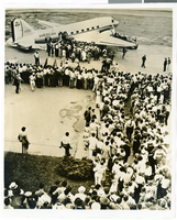
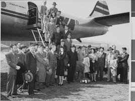
Photograph of a crowd watching Howard Hughes boarding an airliner, circa July 1938
Date
1938-07-15
Archival Collection
Description
Crowd of people watching Howard Hughes board an airliner that was heading for Washington.
Image
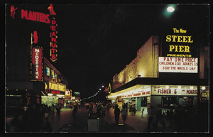
Nighttime view of Atlantic City, New Jersey: postcard
Date
1940 (year approximate) to 1990 (year approximate)
Archival Collection
Description
From Harvey's Hotel and Casino Postcard Collection (PH-00367)
Image
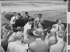
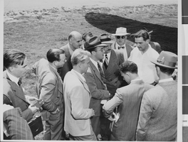
Photograph of Howard Hughes installing radar, Culver City, California, May 03, 1947
Date
1947-05-03
Archival Collection
Description
A view of Howard Hughes conversing with an unidentified group of people in Calfornia.
Image
Photograph of Howard Hughes installing radar, Culver City, California, May 03, 1947
Date
1947-05-03
Archival Collection
Description
A view of Howard Hughes conversing with an unidentified group of people in California.
Image
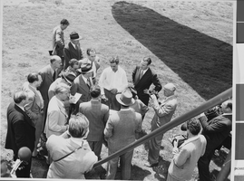
Photograph of Howard Hughes installing radar, Culver City, California, May 03, 1947
Date
1947-05-03
Archival Collection
Description
A view of Howard Hughes conversing with an unidentified group of people in California.
Image
Photograph of Howard Hughes installing radar, Culver City, California, May 03, 1947
Date
1947
Archival Collection
Description
A view of Howard Hughes conversing with an unidentified group of people in Calfornia.
Image
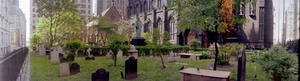
Trinity Church and lower Manhattan from Financial District, New York City, New York: panoramic photograph
Date
1981-05-24
Archival Collection
Description
From the Bob Paluzzi Panoramic Photographs
Image