Search the Special Collections and Archives Portal
Search Results
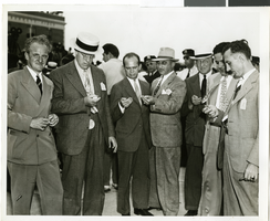
Photograph of a crowd of people awaiting the arrival of Howard Hughes, New York, July 14, 1938
Date
1938-07-14
Archival Collection
Description
The black and white view of members of the Aeronautical Association awaiting the arrival of Howard Hughes and his Lockheed 12 aircraft at the Floyd Bennett Airport in New York. Typed onto a piece of paper attached to the image: "Official timers of Aeronautical Association compare their precision chronometers as Lockheed-14 roars overhead, marking end of Round-the-World flight at Floyd Bennett Airport." Typed onto a second piece of paper also attached to the image: "Official timers of the Aeronautical Association shown at Floyd Bennett Field comparing their precision chronometers as Howard Hughes' plane roared overhead marking the end of his Flight Around The World. July 1938."
Image
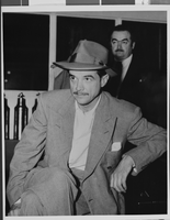
Photograph of Howard Hughes after hearing, Culver City, California, August 15, 1947
Date
1947-08-15
Archival Collection
Description
A view of Howard Hughes attending an informal press conference in Culver City, California, after Hughes left the Senate War Investigating Subcommittee hearing in Washington.
Image
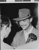
Photograph of Howard Hughes after hearing, Culver City, California, August 15, 1947
Date
1947-08-15
Archival Collection
Description
A view of Howard Hughes attending an informal press conference in Culver City, California, after Hughes left the Senate War Investigating Subcommittee hearing in Washington.
Image
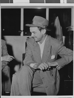
Photograph of Howard Hughes after hearing, Culver City, California, August 15, 1947
Date
1947-08-15
Archival Collection
Description
A view of Howard Hughes attending an informal press conference in Culver City, California, after Hughes left the Senate War Investigating Subcommittee hearing in Washington.
Image
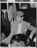
Photograph of Howard Hughes after hearing, Culver City, California, August 15, 1947
Date
1947-08-15
Archival Collection
Description
A view of Howard Hughes attending an informal press conference in Culver City, California, after Hughes left the Senate War Investigating Subcommittee hearing in Washington.
Image
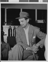
Photograph of Howard Hughes after hearing, Culver City, California, August 15, 1947
Date
1947-08-15
Archival Collection
Description
A view of Howard Hughes attending an informal press conference in Culver City, California, after Hughes left the Senate War Investigating Subcommittee hearing in Washington.
Image
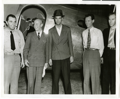
Photograph of Howard Hughes, Tom Thurlow, Harry Connor, Richard Staddart, and Dale Powers, New York, July 4, 1938
Date
1938-07-04
Archival Collection
Description
Howard Hughes, Tom Thurlow, Harry Connor, Richard Staddart, and Dale Powers with an unidentified aircraft behind them in New York. Typed on a piece of paper attached to the image: "Hughes flies to New York for hop to Paris. L to R L. Tom Thurlow and Harry Connor, Hughes, Richard Stoddart and Dale Powers. 7/4/1938."
Image
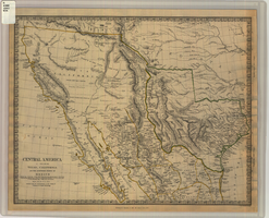
Map of Texas, California, New Mexico and the northern states of Mexico, October 15, 1842
Date
1842-10-15
Description
'Published under the superintendence of the Society for Diffusion of Useful Knowledge.' 'Published by Chapman & Hall, 186 Strand, 15 Oct. 1842.' 'J. & C. Walker, Sculpt.' Scale [ca. 1:7,600,000]. 1 in. to ca. 120 miles (W 125°--W 91°/N 43°--N 23° 30?). 1 map ; 31 x 39 cm. Relief indicated by hachures and spot heights. Shows elevations in yards. Includes notes on exploring expeditions, etc. Borders hand colored. Chapman & Hall.
Image
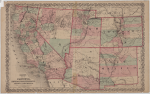
Map of California, Nevada, Utah, Colorado, Arizona & New Mexico, circa 1867
Date
1865 to 1869
Description
39 x 62 cm. Relief shown by hachures and spot heights. Prime meridian: Greenwich and Washington. Hand colored. Shows natural features, populated places, routes of mail steamships, routes of explorers, locations of Indian tribes, railroad routes, and proposed railroad routes. In top margin: No. 80-81. On verso: New Mexico, Arizona, Colorado, Idaho, Dakota (statistics and other information) and The state of California (statistics and other information). Original publisher: G.W. and C.B. Colton.
Image
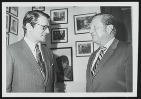
Elliott Richardson, new ambassador to Britain meets with Howard Cannon in his Washington, D.C. office: photographic print
Date
1950 (year approximate) to 1983 (year approximate)
Archival Collection
Description
From the Howard Cannon Photograph Collection (PH-00192)
Image
Pagination
Refine my results
Content Type
Creator or Contributor
Subject
Archival Collection
Digital Project
Resource Type
Year
Material Type
Place
Language
Records Classification
