Search the Special Collections and Archives Portal
Search Results
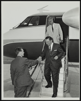
Howard Cannon visits Grumman Aircraft Engineering Plant at Bethpage, Long Island, New York: photographic print
Date
1962-08
Archival Collection
Description
From the Howard Cannon Photograph Collection (PH-00192)
Image
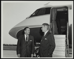
Howard Cannon visits Grumman Aircraft Engineering Plant at Bethpage, Long Island, New York: photographic print
Date
1962-08
Archival Collection
Description
From the Howard Cannon Photograph Collection (PH-00192)
Image
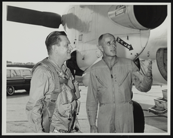
Howard Cannon visits Grumman Aircraft Engineering Plant at Bethpage, Long Island, New York: photographic print
Date
1962-08
Archival Collection
Description
From the Howard Cannon Photograph Collection (PH-00192)
Image
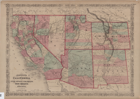
Map of California, Utah, Nevada, Colorado, New Mexico and Arizona, circa 1867
Date
1865 to 1869
Description
39 x 56 cm. Relief shown by hachures. "Entered according to act of Congress in the year 1864, by A.J. Johnson in the Clerks Office of the United States for the Southern District of New York." Atlas page numbers in upper margin: 67-68. Primer meridians: Greenwich and Washington, D.C. On verso: History and statistical view of the West India islands or Columbian Archipelago and Historical and statistical view of Mexico and Central America. Shows proposed railroads, locations of Indian tribes, natural features, counties, mines, mail routes, trails and routes of exploring expeditions. Has decorative border. Southern part of Nevada was added to the state in 1867 and is part of Nevada on this map, but Lincoln County was established in 1867 and is not on this map. This map was still probably published in 1867 in spite of someone's having written "1864" in pencil in the lower right corner of the Library's copy. Original publisher: A.J. Johnson.
Image
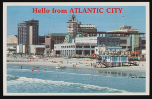
Bally's Park Place, Convention Hall, and other casinos in Atlantic City, New Jersey: postcard
Date
1940 (year approximate) to 1990 (year approximate)
Archival Collection
Description
From Harvey's Hotel and Casino Postcard Collection (PH-00367)
Image
Howard Hughes in a crowd of people after his around-the-world flight, New York City, New York, 1938 July 13
Level of Description
File
Archival Collection
Howard Hughes Professional and Aeronautical Photographs
To request this item in person:
Collection Number: PH-00321
Collection Name: Howard Hughes Professional and Aeronautical Photographs
Box/Folder: Folder 06
Collection Name: Howard Hughes Professional and Aeronautical Photographs
Box/Folder: Folder 06
Archival Component
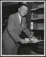
Howard Cannon at opening of a new cafeteria at the United States Senate Restaurant in Washington D.C.: photographic print and correspondence
Date
1964-01-13
Archival Collection
Description
From the Howard Cannon Photograph Collection (PH-00192). Stamped on verso: "By Al. Muto Photos. 210 Gentry Ave., Alexandria, VA."
Mixed Content
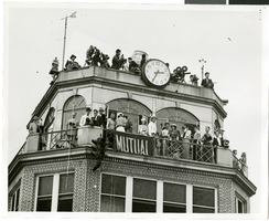
Photograph of people atop a tower awaiting the arrival of Howard Hughes, New York, July 14, 1938
Date
1938-07-14
Archival Collection
Description
The black and white view of a crowd of people, possibly including reporters and members of the press, standing atop a tower as they wait for the arrival of Howard Hughes in his Lockheed 14 aircraft at Floyd Bennett Airport, New York. This final landing for Hughes marked the end of his Round The World flight.
Image

Howard Cannon visits the Air Force Missile Development Center at Holloman Air Force Base, New Mexico: photographic print
Date
1964
Archival Collection
Description
From the Howard Cannon Photograph Collection (PH-00192). Stamped on verso: "Official Air Force Photo - Base Photo Branch - Holloman AFB, New Mexico"
Image

Photograph of Howard Hughes' plane at Floyd Bennet Airfield, New York, August 20, 1938
Date
1938-08-20
Archival Collection
Description
Description given with photograph: "Hughes sets new transcontinental transport mark. Floyd Bennet Field, NY--- Howard Hughes, millionaire flier, setting his famous round-the-world transport plane down here, early August 20th, after a record-smashing flight from Los Angeles. Hughes and three companions completed the trip in 10 hours 32 minutes and 20 seconds, shattering the record of 11 hours and five minutes set four years ago by Tommy Tomlinson. The flight was made most of the way in the substratosphere at an average altitude of 17, 000 feet. Credit Line ACME."
Image
Pagination
Refine my results
Content Type
Creator or Contributor
Subject
Archival Collection
Digital Project
Resource Type
Year
Material Type
Place
Language
Records Classification
