Search Results
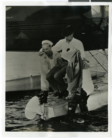
Photograph of Howard Hughes at a U.S. Coast Guard Station, January 15, 1938
Date
Archival Collection
Description
Image
#67125: Benches, Artemus W. Ham Concert Hall, Bees, 2009 July 15
Level of Description
Archival Collection
Collection Name: University of Nevada, Las Vegas Creative Services Records (2000s)
Box/Folder: N/A
Archival Component
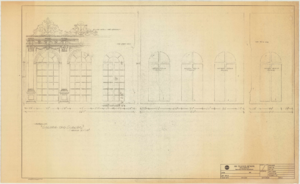
Plan entitled "New City Hall" and other unidentified building and site plans, 2009, undated
Level of Description
Archival Collection
Collection Name: Mark L. Fine Papers
Box/Folder: Oversized Box 7
Archival Component

Savoy Restaurant menu, June 15, 1898
Date
Archival Collection
Description
Text
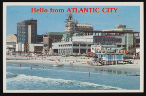
Bally's Park Place, Convention Hall, and other casinos in Atlantic City, New Jersey: postcard
Date
Archival Collection
Description
Image
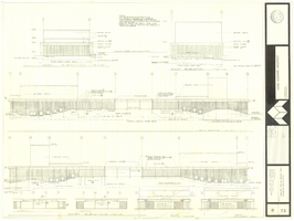
Architectural drawing of concert hall and drama theater, University of Nevada, Las Vegas, exterior elevations, November 5, 1969
Date
Archival Collection
Description
Exterior elevations for the concert hall and drama theater on the University of Nevada, Las Vegas campus, including a connecting courtyard. These buildings would become the Artemus W. Ham Concert Hall and the Judy Bayley Theatre. Sheet 6 of 35. "Drawn by G.T. Checked by K.D. Job number 6828. Scale 1/16" = 1'-0". Date Nov. 5, 1969"
Site Name: University of Nevada, Las Vegas
Address: 4505 S. Maryland Parkway
Image

Map of California, Nevada, Utah, Colorado, Arizona & New Mexico, circa 1867
Date
Description
Image

Photograph of Howard Hughes in cockpit, New York, February 15, 1946
Date
Archival Collection
Description
Image

Map of California, and territories of Utah, Nevada, Colorado, New Mexico and Arizona, 1864
Date
Description
Text
Hall and Mirrors
Date
Archival Collection
Description
Series II. Folies-Bergere production papers, designs, and photographs -- 15th Edition partial revision -- Set design drawings by Charles Lisanby
Image