Search the Special Collections and Archives Portal
Search Results
New York New York Hotel and Casino: postcards, 1997
Level of Description
Archival Collection
Collection Name: Dennis McBride Photograph Collection
Box/Folder: Folder 027
Archival Component
New York New York, press clippings, 1995-2000
Level of Description
Archival Collection
Collection Name: MGM Mirage Records on Mandalay Resort Group
Box/Folder: Box 27
Archival Component
New York-New York Asher Gould presentation, undated
Level of Description
Archival Collection
Collection Name: MGM Mirage Corporation Records
Box/Folder: Box 14
Archival Component
New York-New York advertising contracts, 1998-2001
Level of Description
Archival Collection
Collection Name: MGM Mirage Corporation Records
Box/Folder: Box 02
Archival Component
New York, New York Hotel and Casino, 1997 to 2006
Level of Description
Archival Collection
Collection Name: UNLV Libraries Collection of Gaming Industry Promotional Materials and Reports
Box/Folder: Box 05
Archival Component
Howard Hughes in New York, New York, 1946 September
Level of Description
Archival Collection
Collection Name: Howard Hughes Public Relations Photograph Collection
Box/Folder: Folder 23
Archival Component

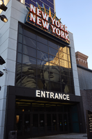
New York New York entrance to "The Park," Las Vegas, Nevada: digital photograph
Date
Archival Collection
Description
Image

New York New York entrance to "The Park," Las Vegas, Nevada: digital photograph
Date
Archival Collection
Description
Image
Las Vegas City Engineering and Planning Department Reports
Identifier
Abstract
The Las Vegas City Engineering and Planning Department Reports (1951-1981) consist of urban planning reports, transportation and parking studies, and environmental impact assessments concerning the greater Las Vegas, Nevada metropolitan area. In addition to general issues of urban planning, the collection contains materials relating to the expansion of Interstate 15 through West Las Vegas in the 1970s and early 1980s.
Archival Collection
#69847: New UNLV faculty members Hyunhwa Lee (Psychosocial Nursing) and Lisa Menegatos (Communication Studies) pose August 15, 2014 at the University of Nevada, Las Vegas, 2014 August 15
Level of Description
Archival Collection
Collection Name: University of Nevada, Las Vegas Creative Services Records (2010s)
Box/Folder: Digital File 00
Archival Component
