Search the Special Collections and Archives Portal
Search Results

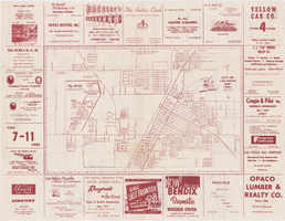
Map of the city of Las Vegas, 1953
Date
1953
Description
24 x 38 cm. on sheet 43 x 56 cm., folded to 28 x 13 cm. Includes advertisements for Las Vegas businesses. Advertisements for Las Vegas businesses, inset map of North Las Vegas, and index on verso. Copyright held by Redwood Pub. Co. Includes inset map of the Strip (U.S. 91 or Los Angeles Highway). Map is irregularly shaped. Original publisher: Redwood Pub. Co..
Image
"The Meadowlands and New York City's Harness Racing Industry", 1987
Level of Description
File
Archival Collection
Eugene Martin Christiansen Papers
Pagination
- Previous page ‹‹
- Page 6
Archival Component
Coalition for Casino Gambling: plan for New York City, undated
Level of Description
File
Archival Collection
Eugene Martin Christiansen Papers
Pagination
- Previous page ‹‹
- Page 6
Archival Component
New York City Council news reports and correspondence, 1990
Level of Description
File
Archival Collection
Eugene Martin Christiansen Papers
Pagination
- Previous page ‹‹
- Page 6
Archival Component
New York City Pizza, menu, approximately 1961 to 1990
Level of Description
File
Archival Collection
UNLV University Libraries Menu Collection
Pagination
- Previous page ‹‹
- Page 6
Archival Component
T-Shirt Color: Gray; Front: City Of New York Fire Dept. FDNY, Dept. Badge W/ New York City Sky Line, approximately 2001-2012
Level of Description
File
Archival Collection
New York-New York Hotel and Casino 9-11 Heroes Tribute Collection
Pagination
- Previous page ‹‹
- Page 6
Archival Component

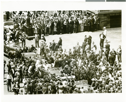
Photograph of Howard Hughes near City Hall, New York City, July 15, 1938
Date
1938-07-15
Archival Collection
Description
Typed onto a piece of paper attached to the image: "At reception for World Fliers. Howard Hughes and Mayor Fiorello Laguardia seated in their parade car as Grover Whalen enters it just before the precession gets underway. 7/15/38."
Image

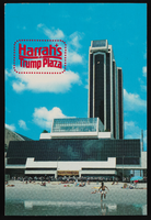
Harrah's at Trump Plaza in Atlantic City, New Jersey: postcard
Date
1940 (year approximate) to 1990 (year approximate)
Archival Collection
Description
From Harvey's Hotel and Casino Postcard Collection (PH-00367)
Image
Proposed Hotel, Atlantic City Convention Center: Atlantic City, New Jersey, 1976 November 22
Level of Description
Series
Archival Collection
Martin Stern Architectural Records
Pagination
- Previous page ‹‹
- Page 6
Archival Component

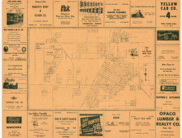
City of Las Vegas map, 1952
Date
1952
Description
General information on Las Vegas and index on verso ; Copyright held by Redwood Publishing Co. ; Includes inset map of the Strip (U.S. 91 or Los Angeles Highway) ; Redwood Publishing Company
Text
Pagination
Refine my results
Content Type
Creator or Contributor
Subject
Archival Collection
Digital Project
Resource Type
Year
Material Type
Place
Language
Records Classification
