Search the Special Collections and Archives Portal
Search Results
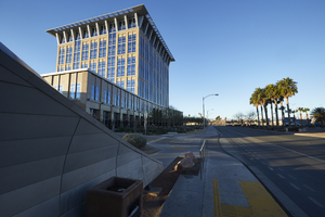
Exterior view of the North Las Vegas City Hall building, looking west in North Las Vegas, Nevada: digital photograph
Date
Archival Collection
Description
From the UNLV University Libraries Photographs of the Development of the Las Vegas Valley, Nevada (PH-00394). Part of the collection documents the entire 19 mile length of the north/south Eastern Avenue / Civic Center Drive alignment. This photograph was captured in the section of Civic Center Drive between Las Vegas Boulevard and Lake Mead Boulevard.
Image
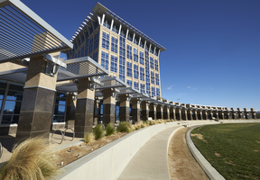
Exterior view of the North Las Vegas City Hall building, looking northeast in North Las Vegas, Nevada: digital photograph
Date
Archival Collection
Description
From the UNLV University Libraries Photographs of the Development of the Las Vegas Valley, Nevada (PH-00394). Part of the collection documents the entire 19 mile length of the north/south Eastern Avenue / Civic Center Drive alignment. This photograph was captured in the section of Civic Center Drive between Las Vegas Boulevard and Lake Mead Boulevard.
Image
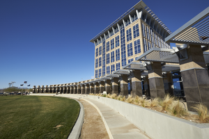
Exterior view of the North Las Vegas City Hall building, looking west in North Las Vegas, Nevada: digital photograph
Date
Archival Collection
Description
From the UNLV University Libraries Photographs of the Development of the Las Vegas Valley, Nevada (PH-00394). Part of the collection documents the entire 19 mile length of the north/south Eastern Avenue / Civic Center Drive alignment. This photograph was captured in the section of Civic Center Drive between Las Vegas Boulevard and Lake Mead Boulevard.
Image
New York City Off-track Betting System Review of Australian Tote Study, 1977
Level of Description
Archival Collection
Collection Name: Eugene Martin Christiansen Papers
Box/Folder: Box 175
Archival Component
New York City Off-track Betting Corporation annual reports, 1990, 1997-1998
Level of Description
Archival Collection
Collection Name: Eugene Martin Christiansen Papers
Box/Folder: Box 041
Archival Component
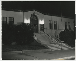
Photograph of Boulder City Public Library, Boulder City (Nev.), 1970s
Date
Archival Collection
Description
Image
New York City trip. Includes correspondence, invitations and copy of speech, 1972 April 13
Level of Description
Archival Collection
Collection Name: Howard Cannon Papers
Box/Folder: Box 04 (Trips)
Archival Component
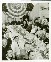
Photograph of a luncheon for the completion of Howard Hughes' Round the World flight, New York City, July 15, 1938
Date
Archival Collection
Description
Image
Construction of library, City Hall and aerial photographs of North Las Vegas Library, 1965-1966
Level of Description
Archival Collection
Collection Name: North Las Vegas Library District Collection on Nevada
Box/Folder: Box 12
Archival Component
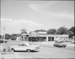
Film transparency of Boulder City Visitors Bureau, Boulder City, Nevada, 1969
Date
Archival Collection
Description
Image
