Search the Special Collections and Archives Portal
Search Results
Valley of Fire, Mount Charleston, Lost City, and Fremont Street, 1937 November 26-1938 February 14
Level of Description
Archival Collection
Collection Name: Robert Woodruff Papers
Box/Folder: Box 08
Archival Component
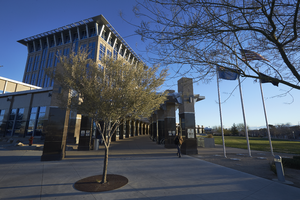
Exterior view of the North Las Vegas City Hall building, looking east-northeast in North Las Vegas, Nevada: digital photograph
Date
Archival Collection
Description
From the UNLV University Libraries Photographs of the Development of the Las Vegas Valley, Nevada (PH-00394). Part of the collection documents the entire 19 mile length of the north/south Eastern Avenue / Civic Center Drive alignment. This photograph was captured in the section of Civic Center Drive between Las Vegas Boulevard and Lake Mead Boulevard.
Image
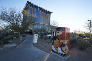
A mural on an electrical box outside of North Las Vegas City Hall, looking east in North Las Vegas, Nevada: digital photograph
Date
Archival Collection
Description
From the UNLV University Libraries Photographs of the Development of the Las Vegas Valley, Nevada (PH-00394). Part of the collection documents the entire 19 mile length of the north/south Eastern Avenue / Civic Center Drive alignment. This photograph was captured in the section of Civic Center Drive between Las Vegas Boulevard and Lake Mead Boulevard.
Image
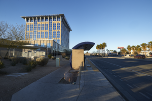
Bus stop in front of the North Las Vegas City Hall building, looking west in North Las Vegas, Nevada: digital photograph
Date
Archival Collection
Description
From the UNLV University Libraries Photographs of the Development of the Las Vegas Valley, Nevada (PH-00394). Part of the collection documents the entire 19 mile length of the north/south Eastern Avenue / Civic Center Drive alignment. This photograph was captured in the section of Civic Center Drive between Las Vegas Boulevard and Lake Mead Boulevard.
Image
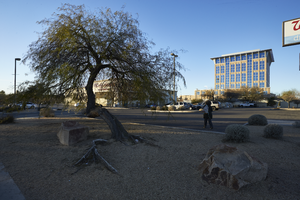
Landscaping in front of North Las Vegas City Hall building and Walgreens, looking west in North Las Vegas, Nevada: digital photograph
Date
Archival Collection
Description
From the UNLV University Libraries Photographs of the Development of the Las Vegas Valley, Nevada (PH-00394). Part of the collection documents the entire 19 mile length of the north/south Eastern Avenue / Civic Center Drive alignment. This photograph was captured in the section of Civic Center Drive between Las Vegas Boulevard and Lake Mead Boulevard.
Image
View of George Washington Bridge to the Verazano Bridge in Manhattan from across the Hudson River, New York City, New York: panoramic photograph, 1980 May 28
Level of Description
Archival Collection
Collection Name: Bob Paluzzi Panoramic Photographs
Box/Folder: Box 04, Digital File 00
Archival Component
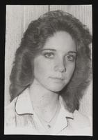
Susan Hall: photographic print
Date
Archival Collection
Description
Image
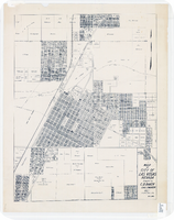
Map of city of Las Vegas, Nevada, October 1, 1940
Date
Description
Image

Map of the city of Las Vegas, Nevada, June 1, 1946
Date
Description
Trust Company
Image
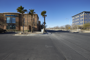
The TruCare Medical building on North McDaniel Street with City Hall, looking west in North Las Vegas, Nevada: digital photograph
Date
Archival Collection
Description
From the UNLV University Libraries Photographs of the Development of the Las Vegas Valley, Nevada (PH-00394). Part of the collection documents the entire 19 mile length of the north/south Eastern Avenue / Civic Center Drive alignment. This photograph was captured in the section of Civic Center Drive between Las Vegas Boulevard and Lake Mead Boulevard.
Image
