Search the Special Collections and Archives Portal
Search Results
Series I. Publications, 1938-1984
Level of Description
Scope and Contents
The Publications series dates from 1938 to 1984 and contains published works by Joanne de Longchamps, as well as poetry magazines in which she made notes on poems by other authors. It includes photocopies of her published poems, journals, anthologies, and books.
Archival Collection
Collection Name: Joanne de Longchamps Papers
Box/Folder: N/A
Archival Component
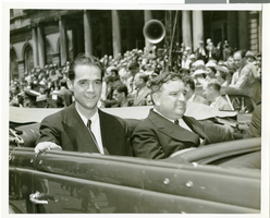
Photograph of Howard Hughes at his parade for Round the World flight, New York City, July 15, 1938
Date
Archival Collection
Description
Image
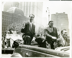
Photograph of Howard Hughes at his parade for Round the World flight, New York City, July 15, 1938
Date
Archival Collection
Description
Image
J. T. McWilliams and family, 1930-1938
Level of Description
Scope and Contents
Materials contain photographs of J. T. McWilliams and the McWilliams family from 1930 to 1938. McWilliams was a surveyor and civil engineer who founded the original Las Vegas townsite (McWilliams Town). He also owned a portion of Lee Canyon, which he donated to become a public park.
Archival Collection
Collection Name: Elbert Edwards Photograph Collection
Box/Folder: N/A
Archival Component
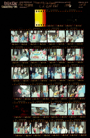
Photographs of March to Los Angeles: L.A. City Hall, Culinary Union, 1992 (folder 1 of 1)
Date
Archival Collection
Description
Arrangement note: Series I. Demonstrations, Subseries I.B. Other Demonstrations and Strikes
Image
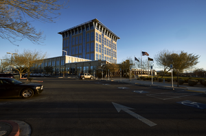
Exterior view of the North Las Vegas City Hall building, looking northeast in North Las Vegas, Nevada: digital photograph
Date
Archival Collection
Description
From the UNLV University Libraries Photographs of the Development of the Las Vegas Valley, Nevada (PH-00394). Part of the collection documents the entire 19 mile length of the north/south Eastern Avenue / Civic Center Drive alignment. This photograph was captured in the section of Civic Center Drive between Las Vegas Boulevard and Lake Mead Boulevard.
Image
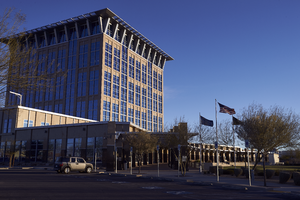
Exterior view of the North Las Vegas City Hall building, looking northeast in North Las Vegas, Nevada: digital photograph
Date
Archival Collection
Description
From the UNLV University Libraries Photographs of the Development of the Las Vegas Valley, Nevada (PH-00394). Part of the collection documents the entire 19 mile length of the north/south Eastern Avenue / Civic Center Drive alignment. This photograph was captured in the section of Civic Center Drive between Las Vegas Boulevard and Lake Mead Boulevard.
Image

Exterior view of the North Las Vegas City Hall campus, looking northeast in North Las Vegas, Nevada: digital photograph
Date
Archival Collection
Description
From the UNLV University Libraries Photographs of the Development of the Las Vegas Valley, Nevada (PH-00394). Part of the collection documents the entire 19 mile length of the north/south Eastern Avenue / Civic Center Drive alignment. This photograph was captured in the section of Civic Center Drive between Las Vegas Boulevard and Lake Mead Boulevard.
Image
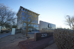
Exterior view of the North Las Vegas City Hall building, looking east in North Las Vegas, Nevada: digital photograph
Date
Archival Collection
Description
From the UNLV University Libraries Photographs of the Development of the Las Vegas Valley, Nevada (PH-00394). Part of the collection documents the entire 19 mile length of the north/south Eastern Avenue / Civic Center Drive alignment. This photograph was captured in the section of Civic Center Drive between Las Vegas Boulevard and Lake Mead Boulevard.
Image
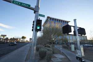
Exterior view of the North Las Vegas City Hall building, looking east in North Las Vegas, Nevada: digital photograph
Date
Archival Collection
Description
From the UNLV University Libraries Photographs of the Development of the Las Vegas Valley, Nevada (PH-00394). Part of the collection documents the entire 19 mile length of the north/south Eastern Avenue / Civic Center Drive alignment. This photograph was captured in the section of Civic Center Drive between Las Vegas Boulevard and Lake Mead Boulevard.
Image
