Search Results
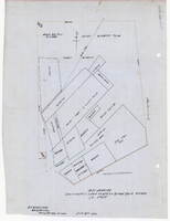
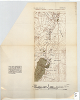
Plat showing cultivated land in the Stewart Ranch, Las Vegas, Nevada, December 8, 1902
Date
Archival Collection
Description
Image

Blueprint showing proposed pipeline for gravity water supply at Las Vegas, Nevada, February 16, 1905
Date
Description
Image
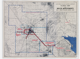
Map showing improvements made to the Las Vegas Valley Water District and vicinity under $8,700,000 bond issue,circa 1957
Date
Description
Image
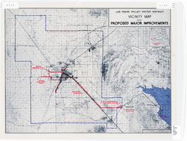
Map showing improvements made to the Las Vegas Valley Water District and vicinity, circa 1950
Date
Description
Image
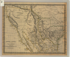
Map of Texas, California, New Mexico and the northern states of Mexico, October 15, 1842
Date
Description
Image
Topographic map of area near Virgin River south of St. Thomas, Nevada, 1936
Date
Archival Collection
Description
Image
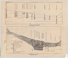
Cross-sections of wells and aquifers in the Las Vegas Valley, circa 1946
Date
Description
Text

Topographic map of Cane Spring, Nevada quadrangle, 1961
Date
Description
Image
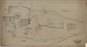
Map showing proposed improvement of Las Vegas Springs, Las Vegas, Nevada, September 21, 1916
Date
Description
'Exhibit A'. 'Approved Sept. 21, 1916.' 'W.E.J.'"--Lower left corner. 'L-44-50 to 61. T-75 - 17 & 46'--Upper left corner. Includes discharge figures and plans for improvements to springs Scale [ca. 1:240]. 1 in. to 20 feet. -- Scale [ca. 1:2,400]. 1 in. to 200 ft. Vertical scale [ca. 1:48]. 1 in. to 4 feet. -- Scale [ca. 1:4,800]. 1 in. to 100 feet. Library's copy has "Proposed layout" written on it in pencil near lower center and other markings in red. Contents: Detail at springs -- Profile -- Alignment.
Image
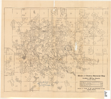
Map of the Goldfield Mining District, Goldfield, Nevada, 1907
Date
Description
Image