Search the Special Collections and Archives Portal
Search Results
History of Blue Diamond Village in Nevada Oral History Project
This is the history of Blue Diamond Village. Blue Diamond is located 26 miles southwest of Las Vegas. The village, originally known as Cottonwood Springs, changed its name when the Blue Diamond Company took ownership of the Gypsum mine and built corporate housing for the workers in the early '20s. Near the base of the Red Rock canyon, Blue Diamond Village was originally a stop on the Old Spanish Trail for traders from Santa Fe, N.M., to California between 1830 and 1848, according to the history committee's findings.
Corporate Body
Desert View Custom Homes, 1990 August 14; 1991 August 05
Level of Description
Scope and Contents
This set includes drawings prepared by Jett Engineering.
Archival Collection
Collection Name: Kenneth H. Childers Architectural Drawings
Box/Folder: Roll 039
Archival Component
Nevada locations, approximately 1978 to 1989
Level of Description
Scope and Contents
The Nevada locations series (approximately 1978-1989) contains images taken by Bob Paluzzi of the Las Vegas, Nevada area and a number taken around Reno and Lake Tahoe, Nevada. Paluzzi photographed many sporting events held at the Caesars Palace, including boxing matches, annual Alan King Tennis Classic tournaments, and Grand Prix races. This series includes images featuring social gatherings and events, like major conventions, unions, the United States Airforce Thunderbirds, and various car clubs. Paluzzi also captured many University of Nevada, Las Vegas football and basketball games, as well as the Las Vegas Stars baseball team. Included in this series are photographs of the Las Vegas Strip and the Fremont Street area during the late-1970s and mid-1980s. There are also a number of images of desert landscapes and natural environments around the Las Vegas Valley.
Archival Collection
Collection Name: Bob Paluzzi Panoramic Photographs
Box/Folder: N/A
Archival Component

Meeting minutes for Consolidated Student Senate, University of Nevada, Las Vegas, March 18, 1980
Date
Archival Collection
Description
Text
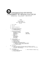
Meeting minutes for Consolidated Student Senate, University of Nevada, Las Vegas, May 06, 1980
Date
Archival Collection
Description
Text
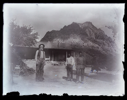
Photograph of the Wilsons at Standstone Ranch, Blue Diamond (Nev.), 1900
Date
Archival Collection
Description
Image
KLAS Channel 8 and Bloomberg news, and Las Vegas City Council meeting: video
Date
Archival Collection
Description
Las Vegas One rebroadcast of KLAS Channel 8 and Bloomberg news reporting, and KCLV Channel 2 recording of a Las Vegas City Council meeting, January 7, 2004. Topics include Cheetahs strip club liquor license, negotiations on the height of the Station Casinos Red Rock tower, Las Vegas searched for dirty nuclear bombs. Original media VHS, color, aspect ratio 4 x 3, frame size 720 x 486. From the Bob Stupak Professional Papers (MS-01016) -- Professional papers -- Audiovisual material -- Digitized audiovisual clips file.
Moving Image
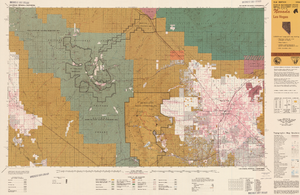
Map of Las Vegas, Nevada and surrounding Bureau of Land Management areas to the west and north, 1994
Date
Description
Text

