Search the Special Collections and Archives Portal
Search Results
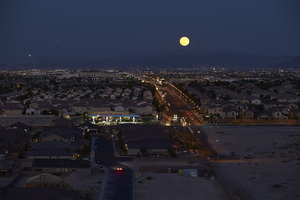
Moonrise over Las Vegas Valley, Spring Valley Township, Nevada: digital photograph
Date
Archival Collection
Description
Image

Telegram from H. I. Bettis to E.L. Selby, May 17, 1905
Date
Archival Collection
Description
Text
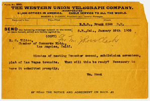
Telegram from William Hood to E. G. Tilton, January 26, 1905
Date
Archival Collection
Description
Text
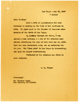
Leter from A. M. Folger to Charles Adams, May 20, 1947
Date
Archival Collection
Description
Text
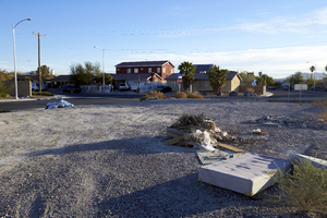
Illegally dumped trash sits in a vacant lot situated along East Branson Avenue, looking northeast, in an industrial and single family home neighborhood of North Las Vegas, Nevada: digital photograph
Date
Archival Collection
Description
From the UNLV University Libraries Photographs of the Development of the Las Vegas Valley, Nevada (PH-00394). Part of the collection documents the entire 19 mile length of the north/south Eastern Avenue / Civic Center Drive alignment. This photograph was captured in the section of Civic Center Drive between Alexander Road and Cheyenne Avenue.
Image
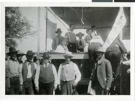
Photograph of Clark townsite auction sale, Las Vegas, May 15-16, 1905
Date
Archival Collection
Description
Image

A semi truck uses a vacant lot with multi-family housing behind on Torino Avenue near Eastern Avenue north of Pebble Road, looking southwest in Las Vegas, Nevada: digital photograph
Date
Archival Collection
Description
From the UNLV University Libraries Photographs of the Development of the Las Vegas Valley, Nevada (PH-00394). Part of the collection documents the entire 19 mile length of the north/south Eastern Avenue / Civic Center Drive alignment. This photograph was captured in the section of Eastern Avenue between Windmill Parkway and Pebble Road.
Image
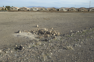
An undeveloped lot on the north side of St. Rose Parkway west of Eastern Avenue, looking north in Las Vegas, Nevada: digital photograph
Date
Archival Collection
Description
From the UNLV University Libraries Photographs of the Development of the Las Vegas Valley, Nevada (PH-00394). Part of the collection documents the entire 19 mile length of the north/south Eastern Avenue / Civic Center Drive alignment. This photograph was captured in the section of Eastern Avenue between Silverado Ranch Boulevard and Coronado Center Drive.
Image
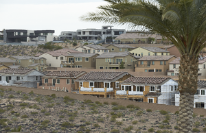
Lennar Development's Aventine neighborhood as seen from Pecos Ridge Parkway west of Eastern Avenue with custom homes above, looking southwest in Henderson, Nevada: digital photograph
Date
Archival Collection
Description
From the UNLV University Libraries Photographs of the Development of the Las Vegas Valley, Nevada (PH-00394). Part of the collection documents the entire 19 mile length of the north/south Eastern Avenue / Civic Center Drive alignment. This photograph was captured in the section of Eastern Avenue between Sunridge Heights Parkway and Grand Hills Drive.
Image

