Search the Special Collections and Archives Portal
Search Results
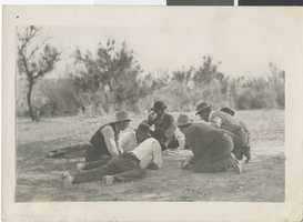
Photograph of people camping on Las Vegas Creek, 1880 - early 1900s
Date
1880 to 1929
Archival Collection
Description
Unidentified people gambling and camping on the Las Vegas Creek below Bonanza. One of the men is Johnnie Horden, probably gambling.
Image
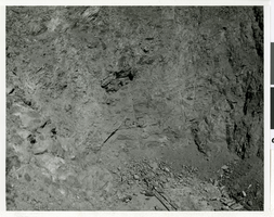
Photograph of the "Mole" Jarva Tunnel Borer at work on the Las Vegas River Mountain Project, Las Vegas, Nevada, circa 1968-1971
Date
1968 to 1971
Archival Collection
Description
The "Mole" Jarva Tunnel Borer pokes its nose out of the tunnel through mountain as work on the Las Vegas River Mountains Project progresses. The first stage of construction was completed between 1968-1971, and is comprised of a main aqueduct, a 3.78 mile tunnel through the River Mountains, eight pumping plants, and 31.4 miles of pipeline. This stage has a peaking capacity of 26.7 million cubic feet of potable water per day. The second stage enlarged the first stage system by expanding some of the existing facilities. New features included five pumping plants, the second barrel to the main aqueduct, and about 30 miles of pipeline and laterals with surge tanks, regulating tanks, and other delivery facilities. In conjunction with this stage, the State of Nevada enlarged and modified the Alfred Merritt Smith water treatment facilities to accommodate additional water supplies. The River Mountains Tunnel was constructed to full capacity in the first stage, and the Saddle Island intake facilities were oversized to accommodate both stages. The aqueduct system has a peaking capability of 53.4 million cubic feet of water per day. The River Mountains Tunnel was constructed during the first stage to accommodate second stage expansion. It is 3.78 miles long and was excavated through the River Mountains, which lie between Las Vegas Valley and Lake Mead. The concrete-lined tunnel has an inside diameter of 121.5 inches, and a maximum capacity of 608 cfs. The SNWA also constructed a larger tunnel, parallel to the River Mountains Tunnel for further expansion. The River Mountains Tunnel is used to convey raw water from Lake Mead to the River Mountains Water Treatment Facility that SNWA constructed near Henderson, NV. The River Mountains Facility, which began delivering treated water in October 2002, treats up to 300 million gallons of water per day, and was designed so it can expand to meet Southern Nevada's needs. In the future, the River Mountains facility will be able to treat up to 600 million gallons of water a day. This facility provides additional reliability and capacity to Southern Nevada's municipal water treatment and distribution capabilities.
Image
Evaluation of Las Vegas Parking Sites: phase II, feasibility prepared for the City of Las Vegas, 1965 November
Level of Description
Item
Archival Collection
Las Vegas City Engineering and Planning Department Reports
To request this item in person:
Collection Number: MS-00270
Collection Name: Las Vegas City Engineering and Planning Department Reports
Box/Folder: Box 02
Collection Name: Las Vegas City Engineering and Planning Department Reports
Box/Folder: Box 02
Archival Component
"Las Vegas in Rhetorical Perspective." Popular Culture West Convention, January 1976, Las Vegas, Nevada. [Conference session], 1976
Level of Description
File
Archival Collection
University of Nevada, Las Vegas Faculty Publications
To request this item in person:
Collection Number: UA-00056
Collection Name: University of Nevada, Las Vegas Faculty Publications
Box/Folder: Box 06
Collection Name: University of Nevada, Las Vegas Faculty Publications
Box/Folder: Box 06
Archival Component
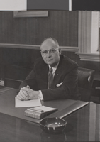
Photograph of Bill Wood, University of Nevada, Las Vegas, circa 1970s
Date
1970 to 1979
Description
Bill Wood, the Dean, Statewide Development Academic Vice President, and Acting President, at University of Nevada, Las Vegas (UNLV).
Image
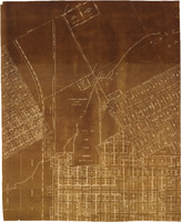
Map of major subdivisions near downtown Las Vegas, Nevada, circa 1931
Date
1928 to 1935
Archival Collection
Description
Map shows deed number and date of deed for some public properties and location and composition of water pipelines. '1-2-31' handwritten in upper right corner. Cadastral maps. Plat map with sepia tone..
Image
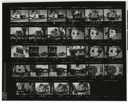
Photograph of Houssels House being moved, Las Vegas (Nev.), 1983
Date
1983
Archival Collection
Description
Proof sheet with images of Houssels House moving from original location, 1012 S. 6th St., Las Vegas, Nevada, to grounds of UNLV campus on Brussells. Photo Reproduction Service Form is included in the photo sleeve. Site Name: Houssels House
Image
Las Vegas Review-Journal newspaper clippings of the Las Vegas Stars baseball team, 1984 April 07
Level of Description
File
Archival Collection
Ortiz Family Collection on the Las Vegas 51s Baseball Team
To request this item in person:
Collection Number: MS-00267
Collection Name: Ortiz Family Collection on the Las Vegas 51s Baseball Team
Box/Folder: Box 01
Collection Name: Ortiz Family Collection on the Las Vegas 51s Baseball Team
Box/Folder: Box 01
Archival Component
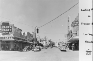
Film transparency showing Fremont Street, Las Vegas, circa 1940s
Date
1946 to 1949
Archival Collection
Description
An image of several hotels and casinos on Fremont Street in downtown Las Vegas, including the Golden Nugget, Frontier Club, Pioneer Club, Boulder Club, and Hotel Apache. Note: A portion of the image (right side, with text) appears to be cut off, but it possibly reads: "Looking West on Fremont Street. Las Vegas, Nevada."
Image
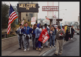
Photographs of Beginning of the Las Vegas to Los Angeles Solidarity March, Culinary Union, Las Vegas (Nev.), 1992 January (folder 1 of 2)
Date
1992-01
Archival Collection
Description
Arrangement note: Series I. Demonstrations, Subseries I.B. Other Demonstrations and Strikes
Image
Pagination
Refine my results
Content Type
Creator or Contributor
Subject
Archival Collection
Digital Project
Resource Type
Year
Material Type
Place
Language
Records Classification
