Search Results
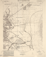
Las Vegas NE quadrangle
Date
Description
Image
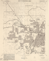
Las Vegas NW quadrangle
Date
Description
Image
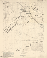
Las Vegas SE quadrangle
Date
Description
Image

Las Vegas SW quadrangle
Date
Description
Image

Plat showing original townsite and subdivisions, Las Vegas, Lincoln County, Nevada, May 1905
Date
Description
Land owned by the San Pedro, Los Angeles & Salt Lake Railroad is outlined. Scale: [ca. 1:12,000]. 1 inch = 1,000 feet. Cadastral map. Blueline print. Additional copy available in the J.T. McWilliams manuscript collection
Image

Map of Las Vegas Valley showing artesian wells, circa 1920
Date
Description
Image

Map of the Las Vegas Strip, May 1950
Date
Description
Image
Law School Study for the University of Nevada, Las Vegas from Southwestern-Nevada Law Review
Date
Archival Collection
Description
A loose paper version of "Law School Study for the University of Nevada, Las Vegas" by Willard H. Pedrick and Lorne Seidman, photocopied from the Southwestern-Nevada Law Review, Volume 10, 1978. From the University of Nevada, Las Vegas William S. Boyd School of Law Records (UA-00048).
Text
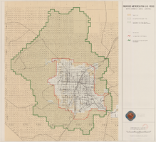
Map showing proposed metropolitan Las Vegas development area, June 24, 1997
Date
Description
Image
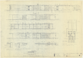
Architectural drawings of a residential home in Las Vegas, Nevada, November 2, 1962
Date
Description
Exterior elevations and details for a residential home on Fifth Place in Las Vegas, Nevada. Sheet no. 4. "Drw. D.H."
Architecture Period: Mid-Century ModernistImage