Search the Special Collections and Archives Portal
Search Results
Henderson Nevada Lake Mead Stake; Fairvew, Pueblo, and Calico Ridge wards, reroof recommendations, 1999 March 12
Level of Description
Archival Collection
Collection Name: Alton Dean Jensen Architectural Records
Box/Folder: Box 270
Archival Component
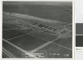
Aerial photograph showing temporary administration building, Basic Magnesium Inc., Henderson, Nevada, November 10, 1941
Date
Archival Collection
Description
Aerial view of Basic Magnesium Inc. plant site looking north towards Whitney Mesa
Transcribed Notes: Transcribed from front of photo: "McNeil construction Co. Magnesium plant, Las Vegas, Nevada, 11-10-41"
Image
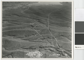
Aerial photograph of booster pumping station site, Basic Magnesium Inc., Henderson, Nevada, January 13, 1942
Date
Archival Collection
Description
Aerial view of Basic Magnesium pipeline between the plant and Lake Mead, looking east towards the causeway and island on Lake Mead.
Transcribed Notes: Transcribed from front of photo: " Basic Magnesium, Inc., Acting for and in behalf of Defense Plant Corp. Plancor 201, Engineers LTD. Contractor, For water services, Las Vegas, Nevada, 1-13-42"
Image
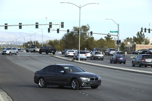
Cars travel on Eastern Avenue at St. Rose Parkway, looking north-west in Henderson, Nevada: digital photograph
Date
Archival Collection
Description
From the UNLV University Libraries Photographs of the Development of the Las Vegas Valley, Nevada (PH-00394). Part of the collection documents the entire 19 mile length of the north/south Eastern Avenue / Civic Center Drive alignment. This photograph was captured in the section of Eastern Avenue between Silverado Ranch Boulevard and Coronado Center Drive.
Image
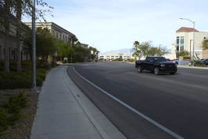
Cars travel on Siena Heights Drive off Eastern Avenue, looking southwest in Henderson, Nevada: digital photograph
Date
Archival Collection
Description
From the UNLV University Libraries Photographs of the Development of the Las Vegas Valley, Nevada (PH-00394). Part of the collection documents the entire 19 mile length of the north/south Eastern Avenue / Civic Center Drive alignment. This photograph was captured in the section of Eastern Avenue between Silverado Ranch Boulevard and Coronado Center Drive.
Image
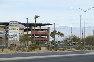
Commercial development on Eastern Avenue near St. Rose Parkway, looking west in Henderson, Nevada: digital photograph
Date
Archival Collection
Description
From the UNLV University Libraries Photographs of the Development of the Las Vegas Valley, Nevada (PH-00394). Part of the collection documents the entire 19 mile length of the north/south Eastern Avenue / Civic Center Drive alignment. This photograph was captured in the section of Eastern Avenue between Silverado Ranch Boulevard and Coronado Center Drive.
Image
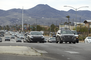
Traffic flows on Eastern Avenue at St. Rose Parkway, looking south-southeast in Henderson, Nevada: digital photograph
Date
Archival Collection
Description
From the UNLV University Libraries Photographs of the Development of the Las Vegas Valley, Nevada (PH-00394). Part of the collection documents the entire 19 mile length of the north/south Eastern Avenue / Civic Center Drive alignment. This photograph was captured in the section of Eastern Avenue between Silverado Ranch Boulevard and Coronado Center Drive.
Image
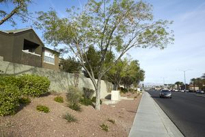
Apartments along Eastern Avenue south of Horizon Ridge Parkway, looking west in Henderson, Nevada: digital photograph
Date
Archival Collection
Description
From the UNLV University Libraries Photographs of the Development of the Las Vegas Valley, Nevada (PH-00394). Part of the collection documents the entire 19 mile length of the north/south Eastern Avenue / Civic Center Drive alignment. This photograph was captured in the section of Eastern Avenue between Coronado Center Drive and Sunridge Heights Parkway.
Image
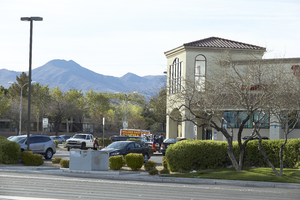
A Walgreens on the corner of Sunridge Heights Parkway and Eastern Avenue, looking south-southeast in Henderson, Nevada: digital photograph
Date
Archival Collection
Description
From the UNLV University Libraries Photographs of the Development of the Las Vegas Valley, Nevada (PH-00394). Part of the collection documents the entire 19 mile length of the north/south Eastern Avenue / Civic Center Drive alignment. This photograph was captured in the section of Eastern Avenue between Coronado Center Drive and Sunridge Heights Parkway.
Image
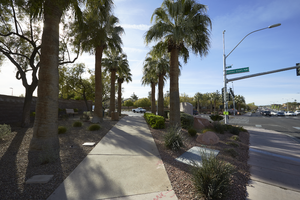
Landscaping and sidewalk on Sunridge Heights Parkway at Eastern Avenue, looking south-southeast in Henderson, Nevada: digital photograph
Date
Archival Collection
Description
From the UNLV University Libraries Photographs of the Development of the Las Vegas Valley, Nevada (PH-00394). Part of the collection documents the entire 19 mile length of the north/south Eastern Avenue / Civic Center Drive alignment. This photograph was captured in the section of Eastern Avenue between Coronado Center Drive and Sunridge Heights Parkway.
Image
