Search Results
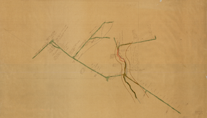
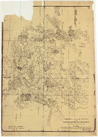
Map of the Clermont Mine, 6th level, Nye County (Nev.), 1900-1925
Date
1900 to 1925
Description
Sectional mining map; hand-drawn and annotated in colored pencil
Image
Tonopah-Goldfield Mining Photograph Collection
Identifier
PH-00023
Abstract
The Tonopah-Goldfield Mining Photograph Collection depicts mining activities in the mining towns of Tonopah and Goldfield in Esmeralda County, Nevada from approximately 1901 to 1920. The photographs primarily depict mines, miners, mills, construction, ore, and workers transporting ore. The photographs also depict events and people in Tonopah and Goldfield, including parades, celebrations, banquets, children, Native Americans, and prominent buildings.
Archival Collection
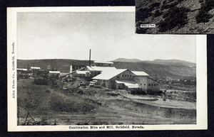
Postcard of the Combination Mine and Mill, Goldfield (Nev.), 1900-1920
Date
1900 to 1920
Archival Collection
Description
Caption: Combination Mine & Mill, Goldfield, Nevada
Image

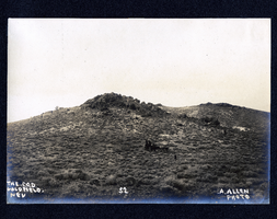
Photograph of men working at the Red Top Mine, Goldfield (Nev.), early 1900s
Archival Collection
Description
Caption: The new strike on the red top. Goldfield
Image
Photograph of horses and carriage on hillside in Goldfield (Nev.), early 1900s
Archival Collection
Description
Caption: The C.O.D. Goldfield. Nev 52
Image
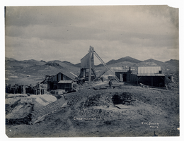
Photograph of Combination Mine, Goldfield (Nev.), early 1900s
Archival Collection
Description
Caption: Combination
Image
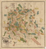
Elmer J. Chute's Map of Goldfield Mining District, Esmeralda and Nye Counties (Nev.), 1905
Date
1905
Description
Scale [ca. 1:20, 400. 1 in.=aprrox. 1,700 feet] ; 1 map : col. ; 60 x 58 cm ; Includes inset location map ; Includes township and range grid ;
Image
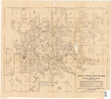
Elmer J. Chute's map of U.S. patent and location surveys in the Goldfield Mining District, Esmeralda and Nye Counties (Nev.), 1907
Date
1907
Description
Scale [ca. 1:22,800. 1 in. to approx. 1900 feet] ; 1 map : col. ; 66 x 82 cm., folded to 18 x 9 cm ; Includes index Includes township and range grid ;
Image
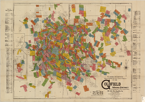
Elmer J. Chute's Diamond Map of the Goldfield Mining District, Esmeralda and Nye Counties (Nev.), 1907
Date
1907
Description
Elmer J. Chute's Diamond Map of the Goldfield Mining District, Esmeralda and Nye Counties (Nev.), 1907
Image
Map of approved mineral surveys in the Goldfield Mining District, Goldfield (Nev.), 1908
Date
1908
Description
Scale [ca. 1:9,600]. 1 in. to 800 feet. (W 117 14'--W 117 09'/N 37 46'--N 37 41') ; 1 map ; 129 x 97 cm ; Blueline print ; Includes township and range grid ; "Copyright 1908 by Davis and Byler. 1911." ; Library's copy has upper-left corner torn off and has circles drawn around and diagonal lines drawn on certain claims ;
Image