Search the Special Collections and Archives Portal
Search Results
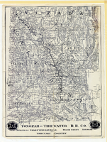
Map showing Tonopah & Tidewater Railroad Company line from Ludlow, California to Goldfield, Nevada, circa 1907
Date
Description
Image
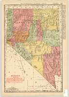
Map showing railroads in Nevada, 1904
Date
Description
Text
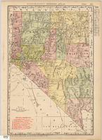
Map showing railroads in Nevada, 1911
Date
Description
Text
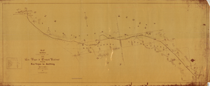
Map showing location of the Las Vegas & Tonopah Railroad from Las Vegas to Bullfrog, Nevada, 1906
Date
Archival Collection
Description
Image
Union Pacific Railroad Collection
Identifier
Abstract
The Union Pacific Railroad Collection (1828-1986) is comprised of the original corporate records of the Union Pacific Railroad's operations in Southern Nevada, Utah, and Southern California, particularly focusing on Las Vegas and Los Angeles. The collection documents the purchase of Stewart ranch and the construction of the original depot and town which became modern Las Vegas. The collection also contains the records of the Las Vegas Land & Water Company (LVL&W), a subsidiary of the railroad formed in 1905 to handle the railroad's land transactions. The collection contains office files, correspondence, reports, leases, various legal, governmental and financial document, the collection contains large and small format maps, architectural and engineering drawings, published technical reports, railroad operational manuals, bound legal briefs, ledgers, and payroll and receipt books. The collection also includes the personal files of Walter Bracken, the Union Pacific's special representative in Nevada and vice president of the Las Vegas Land and Water Company, and a paper index of the collection materials.
Archival Collection
Union Pacific Railroad Photographs
Identifier
Abstract
The Union Pacific Railroad Photographs depict the Union Pacific Railroad Company's tracks, depots, locomotives, and stations in Southern Nevada and Southern California from 1904 to 1973. The photographs primarily depict Union Pacific officials in Las Vegas, Nevada, construction of Boulder City, Nevada and the Hoover (Boulder) Dam, hotels and casinos in Las Vegas, and the aftermath of flooding in 1938 that damaged Union Pacific tracks.
Archival Collection
Las Vegas and Tonopah Railroad Blueprints
Identifier
Abstract
The Las Vegas and Tonopah Railroad Blueprints consists of twenty-four of the original thirty blueprints as part of the Interstate Commerce Commission (I.C.C.) Valuation Index Section I. They are labeled "Right-of-Way & Track Map, Las Vegas & Tonopah Railroad" and dated June 30, 1915. The blueprints contain four miles of railroad lines per sheet with a scale of 6 3/4 inches per mile. The collection also includes one sheet from the Bullfrog Goldfield Railroad company, which used the track, yard, and facilities of the Las Vegas and Tonopah and Railroad company between Beatty and Goldfield, Nevada.
Archival Collection
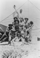
Survey camp, Tonopah Tidewater Railroad in Railroad Valley: photographic print
Date
Archival Collection
Description
From the Nye County, Nevada Photograph Collection (PH-00221) -- Series VII. Other areas in Nye County -- Subseries VII.E. Hawkins Family (Duckwater, Nevada). An inscription on the back of this photo reads: "Survey camp taken in 1909" Tonopah Tidewater Railroad in Railroad Valley, Nye County. Grandfather Roberts with the hat in his hand on top of the pyramid was Grandma Roberts' husband. Grandma was an Irwin." Martha Roberts Hawkins indicates that this inscription is wrong, that The Tonopah Tidewater Railroad never came to Railroad Valley and the railroad's construction was completed prior to 1909. The man pictured on top waving a hat is Frank Roberts, born in 1886. Photo is believed to be a survey crew for the Tonopah and Tidewater Railroad.
Image
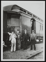
Railroad employees: photographic print
Date
Archival Collection
Description
Image
