Search the Special Collections and Archives Portal
Search Results
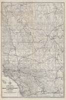
Map of a portion of southern California and southwestern Nevada embracing the arid region of Mojave & Colorado Deserts including Death Valley, circa 1937
Date
1937 (year approximate)
Description
79 x 52 cm. Panel title: Road map of the Mojave and Colorado Deserts including Death Valley National Monument. Index on verso. Relief shown by hachures and spot heights. In lower right-hand corner: Burke Douglas Pflum. "3712."--Lower left-hand corner of copy 1. "C13247."--Lower left-hand corner of copy 2. "1379."--Lower right-hand corner. Originally folded to 28 x 11 cm. On verso: Map showing roads and points of interest in Death Valley and vicinity. Original publisher: The Club.
Image
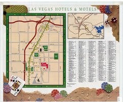
Map of Las Vegas hotels & motels, June 1990
Date
1990-06
Description
Color; 33 x 27 cm. on sheet 46 x 55 cm., folded to 23 x 10 cm. Panel title: Las Vegas area map. Shows locations of hotel and motels in the area of the Strip and Downtown. Also shows locations of country clubs. Includes a separate map of locations of hotels and motels in the surrounding area including North Las Vegas. Includes index. "LVM-75M-6/90."--Verso. Map of locations of golf courses on the verso along with information on points of interest, attractions, general information, tennis, bowling, recreational vehicle parks, and golf.
Image
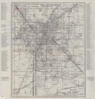
Street map of greater Las Vegas, 1963
Date
1963
Description
55 x 44 cm. Panel title: Front Boy's official 1963-1964 edition street map : detailed guide of North Las Vegas, Las Vegas, Paradise Valley and vicinity. Relief shown by spot heights. Originally folded to: 29 x 12 cm. "Note, revised and recorded 1st - 1961, 2nd - 1962, 3rd 1963, 4th - 1963."On verso: "MAR 1964" stamped in red ink on upper right hand corner. Includes notes and quotations. Includes indexes. Original publisher: Front.
Image
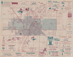
Map of the city of Las Vegas, North Las Vegas, the "Strip", 1957
Date
1957
Description
35 x 50 cm., folded to 22 x 10 cm. 1958 edition. Copyright held by Robert E. Barringer. Panel title: Welcome map, greater Las Vegas area and scenic routes to and from there. "The Raele McCoy Co." Map is irregularly shaped. Index on verso. Includes advertisements for Las Vegas businesses and notes. Birdseye-view map The Las Vegas area : wonderland of the West : on the Old Spanish Trail; advertisements and helpful information on Las Vegas on verso. "1958 edition." Original publisher: Redwood Publishing Co..
Image
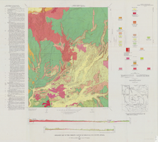
Geologic map of the Thirsty Canyon quadrangle, Nye County, Nevada, 1966
Date
1966
Description
57 x 46 cm., on sheet 83 x 91 cm., folded in envelope 30 x 24 cm. Relief shown by contours and spot heights. "Geology mapped in 1963." Includes 2 colored cross sections, index map, text, and quadrangle location map. "Prepared in cooperation with the U. S. Atomic Commission." Original publisher: Interior, Geological Survey, Series: Geologic quadrangle map GQ, Scale: 1:24 000.
Image
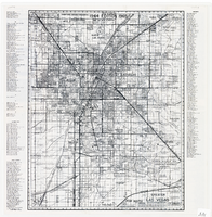
Map of greater Las Vegas area, 1964-1965
Date
1964 to 1965
Description
Scale [ca. 1:51,322] ; 1 map ; 55 x 43 cm ; Panel title: Front Boy's official 1964-1965 edition street map : detailed guide of North Las Vegas, Las Vegas, Paradise Valley and vicinity ; Originally folded to: 29 x 12 cm ; Relief shown by spot heights ; Includes notes and quotations ; Includes indexes; Alt Title: Front Boy's official 1964-1965 edition street map : detailed guide of North Las Vegas, Las Vegas, Paradise Valley and vicinity ; Alt Title: Official 1964-1965 edition street map Front Boy Service Co..
Text
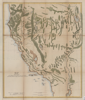
Map showing the different routes travelled over by the detachments of the Overland Command in the spring of 1855 from Salt Lake City, Utah, to the Bay of San Francisco, 1855
Date
1855
Description
57 x 47 cm., folded to 22 x 13 cm. Indicates routes of Capt. Ingalls, Col. Steptoe,and Lt. Mowrey, and shows camping grounds. Relief shown by hachures. Graphic scale given in geographical as well as statute miles. "Ackerman Lith. 319 Broadway, N.Y." Hand colored. Original publisher unknown, Series: House Ex. Doc. No. 1, 1st session, 34th Congress.
Image

Photograph of Sawyers and others at event, Carson City (Nev.), 1959-1967
Date
1959 to 1967
Archival Collection
Description
Governor Sawyer (4th from left) and his wife, Bette, (2nd from left) sit on folding chairs with California Governor Pat Brown (1st from left) and another unidentified man at an inaugural event, likely at the Governor's Mansion. The men all wear tuxedoes and bow ties, and Mrs. Sawyer wears a gown and gloves. See Image 0131 0391 for another image from this event.
Image
Pagination
Refine my results
Content Type
Creator or Contributor
Subject
Archival Collection
Digital Project
Resource Type
Year
Material Type
Place
Language
Records Classification

