Search Results

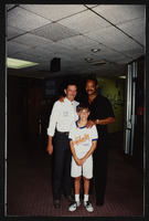
Frontier Strike rally with Jesse Jackson, C, Culinary Union, Las Vegas (Nev.), 1990s (folder 1 of 1), image 7
Date
1990 to 1999
Description
Arrangement note: Series I. Demonstrations, Subseries I.A. Frontier Strike
Image

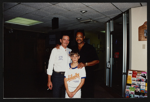
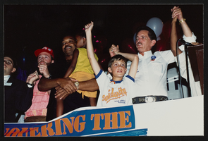
Frontier Strike rally with Jesse Jackson, C, Culinary Union, Las Vegas (Nev.), 1990s (folder 1 of 1), image 8
Date
1990 to 1999
Description
Arrangement note: Series I. Demonstrations, Subseries I.A. Frontier Strike
Image

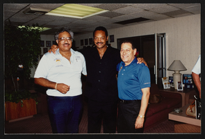
Frontier Strike rally with Jesse Jackson, C, Culinary Union, Las Vegas (Nev.), 1990s (folder 1 of 1), image 9
Date
1990 to 1999
Description
Arrangement note: Series I. Demonstrations, Subseries I.A. Frontier Strike
Image

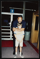
Frontier Strike rally with Jesse Jackson, C, Culinary Union, Las Vegas (Nev.), 1990s (folder 1 of 1), image 10
Date
1990 to 1999
Description
Arrangement note: Series I. Demonstrations, Subseries I.A. Frontier Strike
Image
Frontier Strike rally with Jesse Jackson, C, Culinary Union, Las Vegas (Nev.), 1990s (folder 1 of 1), image 11
Date
1990 to 1999
Description
Arrangement note: Series I. Demonstrations, Subseries I.A. Frontier Strike
Image
Frontier Strike rally with Jesse Jackson, C, Culinary Union, Las Vegas (Nev.), 1990s (folder 1 of 1), image 12
Date
1990 to 1999
Description
Arrangement note: Series I. Demonstrations, Subseries I.A. Frontier Strike
Image

Frontier Strike rally with Jesse Jackson, C, Culinary Union, Las Vegas (Nev.), 1990s (folder 1 of 1), image 13
Date
1990 to 1999
Description
Arrangement note: Series I. Demonstrations, Subseries I.A. Frontier Strike
Image
Frontier Strike rally with Jesse Jackson, C, Culinary Union, Las Vegas (Nev.), 1990s (folder 1 of 1), image 14
Date
1990 to 1999
Description
Arrangement note: Series I. Demonstrations, Subseries I.A. Frontier Strike
Image
Frontier Strike rally with Jesse Jackson, C, Culinary Union, Las Vegas (Nev.), 1990s (folder 1 of 1), image 15
Date
1990 to 1999
Description
Arrangement note: Series I. Demonstrations, Subseries I.A. Frontier Strike
Image
Frontier Strike rally with Jesse Jackson, C, Culinary Union, Las Vegas (Nev.), 1990s (folder 1 of 1), image 16
Date
1990 to 1999
Description
Arrangement note: Series I. Demonstrations, Subseries I.A. Frontier Strike
Image