Search the Special Collections and Archives Portal
Search Results
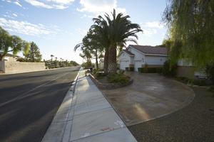
Single family home with circular driveway east of Buffalo Drive and north of West Sahara Avenue, looking east Las Vegas, Nevada: digital photograph
Date
2017-10-11
Archival Collection
Description
A house with a circular driveway sits along Via Olivero Avenue east of Buffalo Drive and north of West Sahara Avenue.
Image
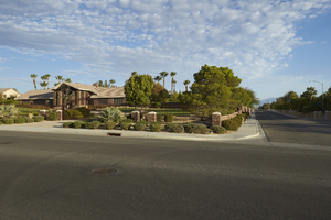
Luxury home in a neighborhood east of Buffalo Drive and north of West Sahara Avenue, looking north, Las Vegas, Nevada: digital photograph
Date
2017-10-11
Archival Collection
Description
A custom home occupies the northwest corner of Via Olivero Avenue and Tioga Way near Buffalo Drive and West Sahara Avenue.
Image
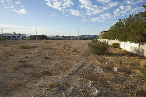
Vacant land on West Sahara Avenue east of Buffalo Drive, looking south, Las Vegas, Nevada: digital photograph
Date
2017-10-11
Archival Collection
Description
Undeveloped land sits empty on West Sahara Avenue east of Buffalo Drive as seen from Via Olivero Avenue.
Image
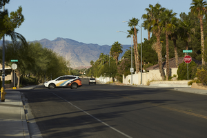
Car on Buffalo Drive at Via Olivero Avenue, looking west, Las Vegas, Nevada: digital photograph
Date
2017-10-11
Archival Collection
Description
A car dries on Buffalo Drive north of West Sahara Avenue as seen from Via Olivero Avenue.
Image
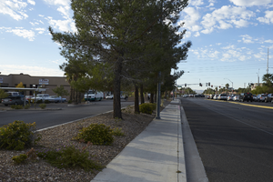
Commercail property along Buffalo Drive north of West Sahara Avenue, looking south, Las Vegas, Nevada: digital photograph
Date
2017-10-11
Archival Collection
Description
Businesses line Buffalo Drive north of West Sahara Avenue.
Image
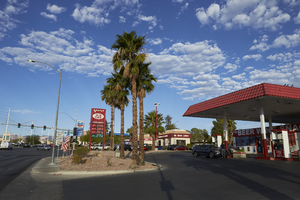
Gas staions at Buffalo Drive and West Sahara Avenue, looking west, Las Vegas, Nevada: digital photograph
Date
2017-10-11
Archival Collection
Description
A U.S. Gas station and convenance store occupies the northeast corner of Buffalo Drive and West Sahara Avenue.
Image
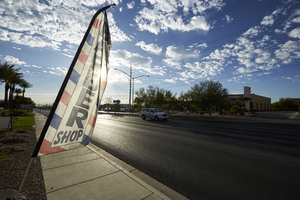
Barber shop advertisement West Sahara Avenue east of Buffalo Drive, looking west, Las Vegas, Nevada: digital photograph
Date
2017-10-11
Archival Collection
Description
A flag advertises a barber shop in the area of Buffalo Drive and West Sahara Avenue.
Image
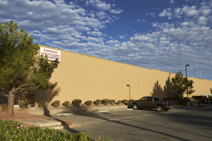
Commercial development on West Sahara Avenue east of Buffalo Drive, looking northwest, Las Vegas, Nevada: digital photograph
Date
2017-10-11
Archival Collection
Description
One commercial building sits on the property line with another on West Sahara Avenue east of Buffalo Drive.
Image
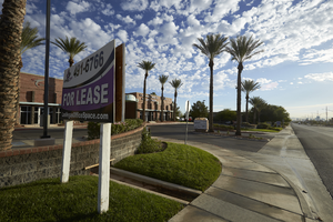
Commercial property on West Sahara Avenue east of Buffalo Drive, looking northeast, Las Vegas, Nevada: digital photograph
Date
2017-10-11
Archival Collection
Description
A leasing sign sits out front of a commercial property on West Sahara Avenue east of Buffalo Drive.
Image
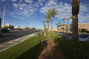
Landscaping with grass and palm trees on West Sahara Avenue east of Buffalo Drive, looking west, Las Vegas, Nevada: digital photograph
Date
2017-10-11
Archival Collection
Description
Landscaping at commercial properties along West Sahara Avenue east of Buffalo Drive.
Image
Pagination
Refine my results
Content Type
Creator or Contributor
Subject
Archival Collection
Digital Project
Resource Type
Year
Material Type
Place
Language
Records Classification
