Search Results
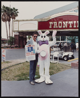
Frontier Easter Bunny and food drive, Culinary Union, Las Vegas (Nev.), 1992 April 14 (folder 1 of 1), image 20
Date
1992-04-14
Description
Arrangement note: Series II. Public Events
Image
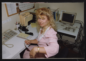
Meeting with governor Bob Miller, Culinary Union, Las Vegas (Nev.), 1992 June 26 (folder 1 of 1), image 1
Date
1992-06-26
Description
Arrangement note: Series II. Public Events
Image

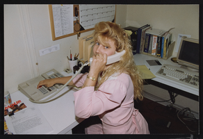
Meeting with governor Bob Miller, Culinary Union, Las Vegas (Nev.), 1992 June 26 (folder 1 of 1), image 2
Date
1992-06-26
Description
Arrangement note: Series II. Public Events
Image
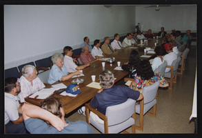
Meeting with governor Bob Miller, Culinary Union, Las Vegas (Nev.), 1992 June 26 (folder 1 of 1), image 3
Date
1992-06-26
Description
Arrangement note: Series II. Public Events
Image

Meeting with governor Bob Miller, Culinary Union, Las Vegas (Nev.), 1992 June 26 (folder 1 of 1), image 4
Date
1992-06-26
Description
Arrangement note: Series II. Public Events
Image

Meeting with governor Bob Miller, Culinary Union, Las Vegas (Nev.), 1992 June 26 (folder 1 of 1), image 5
Date
1992-06-26
Description
Arrangement note: Series II. Public Events
Image

Meeting with governor Bob Miller, Culinary Union, Las Vegas (Nev.), 1992 June 26 (folder 1 of 1), image 6
Date
1992-06-26
Description
Arrangement note: Series II. Public Events
Image

Meeting with governor Bob Miller, Culinary Union, Las Vegas (Nev.), 1992 June 26 (folder 1 of 1), image 7
Date
1992-06-26
Description
Arrangement note: Series II. Public Events
Image
Meeting with governor Bob Miller, Culinary Union, Las Vegas (Nev.), 1992 June 26 (folder 1 of 1), image 8
Date
1992-06-26
Description
Arrangement note: Series II. Public Events
Image

Meeting with governor Bob Miller, Culinary Union, Las Vegas (Nev.), 1992 June 26 (folder 1 of 1), image 9
Date
1992-06-26
Description
Arrangement note: Series II. Public Events
Image