Search Results
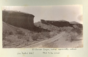
Photograph of Roofed Hills and the road to the mines, Eldorado Canyon (Nev.), 1900-1925
Date
1900 to 1925
Description
Caption: El Dorado Canyon, looking approximately westward. (the Roofed Hills) (Road to the mines)
Image
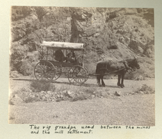
Photograph of a covered wagon on a dirt road, Eldorado Canyon (Nev.), 1900-1925
Date
1900 to 1925
Description
Caption: The rig grandpa used between the mines and the mill settlement.
Image
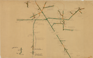
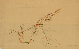
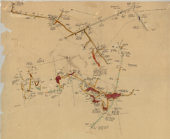
Map of the Combination Mine, 380 ft., Nye County (Nev.), 1900-1925
Date
1900 to 1925
Description
Sectional mining map; hand-drawn and annotated in colored pencil
Image
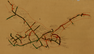
Map of the Combination Mine, 328 ft., Nye County (Nev.), 1900-1925
Date
1900 to 1925
Description
Sectional mining map; hand-drawn and annotated in colored pencil
Image
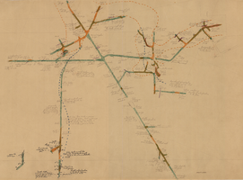
Map of the Combination Mine, 130 ft., Nye County (Nev.), 1900-1925
Date
1900 to 1925
Description
Sectional mining map; hand-drawn and annotated in colored pencil
Image
Map of the Combination Mine, 330 ft., Nye County (Nev.), 1900-1925
Date
1900 to 1925
Description
Sectional mining map; hand-drawn and annotated in colored pencil
Image
Map of the Locke Mine, 380 ft., Nye County (Nev.), 1900-1925
Date
1900 to 1925
Description
Sectional mining map; hand-drawn and annotated in colored pencil
Image
Map of the Combination Mine, 280 ft., Esmeralda County (Nev.), 1900-1925
Date
1900 to 1925
Description
Sectional mining map; hand-drawn and annotated in colored pencil
Image
Map of the Clermont Mine, 600 ft., Nye County (Nev.), 1900-1925
Date
1900 to 1925
Description
Sectional mining map; hand-drawn and annotated in colored pencil
Image
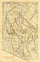
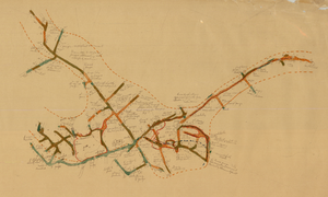
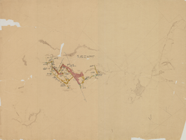
Map of the Goldfield Deep Mines Company of Nevada, Goldfield (Nev.), 1900-1925
Date
1900 to 1925
Description
Caption: Boundary drawn in red, surrounding mines named
Image