Search the Special Collections and Archives Portal
Search Results
Union Pacific Railroad: contains architectural and structural drawings of passenger and freight stations in Ontario, California and San Bernardino, California. Includes station yard layout plans, Ontario street maps (1939), and San Berdino tract maps (1928), 1925 December 31-1943 August 14
Level of Description
File
Archival Collection
Union Pacific Railroad Collection
To request this item in person:
Collection Number: MS-00397
Collection Name: Union Pacific Railroad Collection
Box/Folder: Flat File 192
Collection Name: Union Pacific Railroad Collection
Box/Folder: Flat File 192
Archival Component

Map of Lincoln County, Nevada and Mohave County, Arizona area, 1892
Date
1892
Description
'Henry Gannett, chief geographer ; A.H. Thompson, geographer in charge ; triangulation by H.M. Wilson ; topography by H.M. Wilson and Powell survey.' 'Edition of Mar. 1892, reprinted 1929.' Handwritten legend on right-side margin of map. Original publisher: Dept. of the Interior, U.S. Geological Survey. Scale 1:250,000polyconic proj. (W 115°--W 114°/N 37°--N 35°).
Image

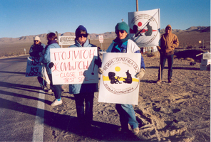
Protestors of the Nevada-Semipatatinsk antinuclear movement: photographic print
Date
1980 (year approximate) to 2000 (year approximate)
Archival Collection
Description
Unidentified protestors hold posters in representation of the Nevada-Semipatatinsk Antinuclear movement at the Nevada Test Site circa 1980-1999.
Image
#68562: Equity in Education: Celebrating 40 Years of Title IX panel discussion with Judith Sweet, Carol Harter, Peg Rees and Nancy Lough inside the Hendrix Auditorium on April 19, 2012, 2012 April 19
Level of Description
File
Archival Collection
University of Nevada, Las Vegas Creative Services Records (2010s)
To request this item in person:
Collection Number: PH-00388-05
Collection Name: University of Nevada, Las Vegas Creative Services Records (2010s)
Box/Folder: Digital File 00
Collection Name: University of Nevada, Las Vegas Creative Services Records (2010s)
Box/Folder: Digital File 00
Archival Component

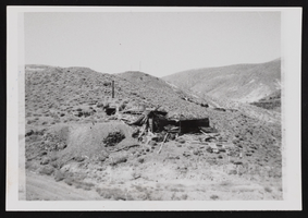
Candelaria Ruins of Mt. Diablo, Nevada: photographic prints
Date
1971-03-09
Description
From the Nan Doughty Photograph Collection (PH-00240). Candelaria Ruins of Mt. Diablo superintendent's house in Pickhandle Gulch, mouth of tunnel, behind fallen roof is where William H. Shockley kept milk and butter cool and stored books and papers during his absence.
Image
Boulder City, Nevada Financial Reports and Budgets
Identifier
MS-00695
Abstract
Collection is comprised of annual budgets, financial statements, and auditor's reports dating from 1976 to 1989 created for the city of Boulder City, Nevada and adopted by the City Council.
Archival Collection

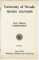
Nevada Southern First Annual Commencement program
Date
1964-06-03
Archival Collection
Description
University of Nevada, Nevada Southern, First Annual Commencement, Las Vegas, June 3, 1964.
Text
Nevada Research Labs Photographs
Identifier
PH-00418
Abstract
The Nevada Research Labs Photographs (1958-1964) include three folders containing aerial photographic prints depicting flood plains in Nevada and the Nevada Test Site.
Archival Collection

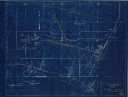
Map showing profile of 24-inch cast iron water pipeline for Las Vegas, Nevada, May 20, 1930
Date
1930-05-20
Archival Collection
Description
'As constructed. Drawing W.O. - 8577. Office of Chief Engineer, Los Angeles. Drawing No. 41092.' 'Scale for details 1"=10'. 5-20-1930. P.F.D.' 'Scale 1"=100'.' 'Profile of new 24" CI pipe. Scale 1"=600'. Ver. 1"=20'.' Blueprint. Map of the water pipes for Las Vegas. Includes the buildings in the railroad yard, a detailed map of a section of the pipe, a profile of the 24 inch C.I. pipe, and a map of the point of diversion. Date of detailed map is 5-20-1930. Library's copy has hand-written additions in color. Los Angeles & Salt Lake Railroad Co., Office of Chief Engineer,
Image
Pagination
Refine my results
Content Type
Creator or Contributor
Subject
Archival Collection
Digital Project
Resource Type
Year
Material Type
Place
Language
Records Classification

