Search Results

Topographic map of groundwater in the southeast quadrangle of Las Vegas, Nevada, 1980
Date
Description
Text
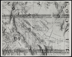
Topographic map of Nevada and California: map
Date
Description
Image
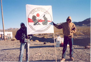
Two unidentified protestors hold a Nevada-Semipalatinsk sign: photographic print
Date
Archival Collection
Description
Image
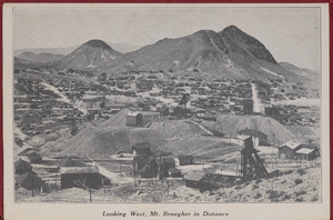
"Souvenir of Tonopah, Nevada" with photos from Goldfield, Tonopah, and Searchlight, Nevada: photograph album, image 003
Description
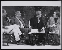
Photograph of Binion and others on the Merv Griffin show, Las Vegas, Nevada, approximately 1960 to 1979
Date
Archival Collection
Description
L-R: Jack Klugman, Benny Binion, Merv Griffin on the Merv Griffin TV show. (1960s-70s)
Image
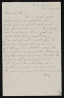
Letter from May [?], Bunkerville, Nevada to John M. Bunker, Eldorado Canyon, Nevada
Date
Archival Collection
Description
From the Syphus-Bunker Papers (MS-00169). The folder contains an original handwritten letter and a typed transcription of the same letter, and a copy of the original letter. Letter does not state May's last name but she seems to be the brother of John M. Bunker.
Text
UNLV University Libraries Photographs of the Jewish Community of Southern Nevada
Identifier
Abstract
The UNLV University Libraries Photographs of the Jewish Community of Southern Nevada (2015-2018) are comprised of digital images captured as part of the Southern Nevada Jewish Heritage Project. The photographs include members of the Southern Nevada Jewish community, synagogues Temple Beth Sholom (current and original site), Congregation Ner Tamid (including aerials), Chabad of Las Vegas, Temple Sinai, and Midbar Kodesh Temple. There are also photographs of The Desert Torah Academy's Robert Cohen Educational Campus, the future site of Chabad of Green Valley, the Holocaust Resource Center, Manpower Las Vegas’s 50th anniversary celebration, and the House of Straus.
Archival Collection
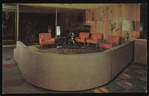
Interior view of the Sahara Hotel lobby in Las Vegas, Nevada: postcard
Date
Archival Collection
Description
Image

Artistic rendition of the Monte Carlo Club in Las Vegas, Nevada: postcard
Date
Archival Collection
Description
Image
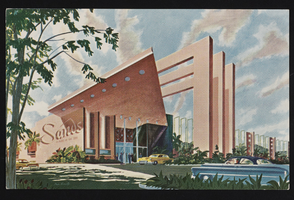
Artistic rendition of the Sands Hotel and Casino in Las Vegas, Nevada: postcard
Date
Archival Collection
Description
Image