Search Results
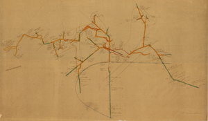
Map of the 450 foot level of the Mohawk Mine, Goldfield, Nevada, circa 1902-1908
Date
Description
Image
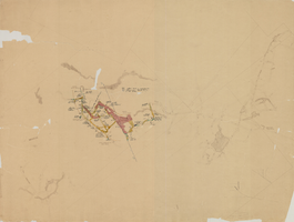
Map of the 280 foot level of the Combination Mine, Goldfield, Nevada, circa 1902-1908
Date
Description
Image
Collection on the Las Vegas, Nevada Jewish Community
Identifier
Abstract
The Collection on the Las Vegas, Nevada Jewish Community spans from 1964 to 2006 and is comprised of scrapbooks, genealogies, ephemera, and other material produced by or for the community. The Hadassah scrapbooks date from 1964 through 1971 and contain invitations, photographs, and records of events and fundraising efforts. Material related to various congregations includes bulletins, fliers, correspondence (form letters), photographs, newspaper clippings, and recorded media. The Jewish Genealogy Society records include bulletins, newsletters, and meeting agendas. Also included is a family genealogy.
Archival Collection
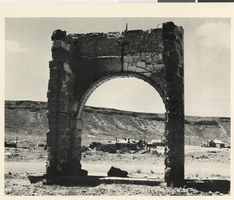
Photograph of ruins at Goldfield, Nevada, 1973
Date
Archival Collection
Description
Image

Geologic map of Las Vegas Valley, Nevada, 1982
Date
Description
Image
Carver's Station, Nevada: photographic print
Date
Archival Collection
Description
From the Nye County, Nevada Photograph Collection (PH-00221) -- Series V. Smoky Valley, Nevada and Round Mountain, Nevada -- Subseries V.A. Carver, Carver-Duhme, and Carver-Book Families (Smoky Valley). The facility was of modular construction. The Carvers purchased a building from Wallace Bird and moved it from Round Mountain to their ranch, where it served as the bar. Carver traded Bird hay for the building. Carver purchased another building in Monarch, located just south of Belmont. The building was moved to the Carver ranch by the Boni brothers, and it became the Carvers' living quarters. The dance hall was constructed in 1949 and is visible to the right of the porch. The Carvers tried to have dances on a regular basis, but holding them proved to be a lot of work.
Image
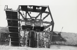
Dredge in Manhattan, Nevada: photographic print
Date
Archival Collection
Description
From the Nye County, Nevada Photograph Collection (PH-00221) -- Series VII. Other areas in Nye County -- Subseries VII.I. Wilson Family (Toiyabe Mountains, Nevada). In the center of the dredge the screw elevator can be seen. It brought the placer material from the bucket elevator on board the dredge where it was processed. It is said that it took 100 workers to assemble the dredge. The dredge could process between 500 and 1,000 tons of gravel per hour.
Image
Annotated Bibliography for Biologic Overview for the Nevada Nuclear Waste Storage Investigations - Nevada Test Site, Nye County, Nevada, 1981 December
Level of Description
Archival Collection
Collection Name: Yucca Mountain Site Characterization Office Collection
Box/Folder: Box 46
Archival Component
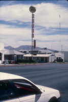
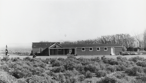
Slide of the Desert Moon Motel, Nevada, 1986
Date
Archival Collection
Description
Image
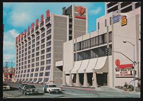
The Sundowner Hotel in Reno, Nevada: postcard
Date
Archival Collection
Description
Image