Search Results
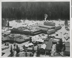
Aerial photograph of Harrah's Tahoe from the southwest (Stateline, Nev.), circa 1960
Date
Archival Collection
Description
Aerial view of Harrah's Tahoe from the southwest.
Site Name: Harrah's Tahoe
Address: 15 Highway 50
Image
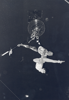
Photograph of aerial performers at Circus Circus, Las Vegas, Nevada, circa 1968
Date
Archival Collection
Description
Image
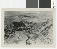
Aerial photograph of Las Vegas, partial view of high school, southwest direction, 1930
Date
Archival Collection
Description
Aerial view of Las Vegas in 1930
Transcribed Notes: Handwritten collection note on back of photo: Aerial view of Las Vegas showing Fifth St. and Main St., c. 1933; Notes on photo sleeve: Aerial view of Las Vegas 'taken in a clip wing Jenny. Date is winter of 1930. Plane had a wooden propeller open cockpit. Pilot had a contract with Bureau of Reclamation to fly aerial photos in a grid. Took Wint (up in) the plane this day because it was too windy (for the pilot) to take his regular aerials.' (James J. Hester, son-in-law of W.A. Davis ('Wint'), the photographer who took this. Note added 4-92.
Image
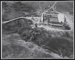
Aerial photograph of Binion's Ranch and cars in Jordan, Montana, approximately 1940 to 1985
Date
Archival Collection
Description
Aerial view of the Binion Ranch near Jordan in north-eastern Montana. Stamp on back of photo: " Carp's Photo P. O. Box 1773 Billings, Montana".
Image

Film transparency showing an aerial view of Hoover Dam and Lake Mead, circa mid 1930s-1950s
Date
Archival Collection
Description
Image
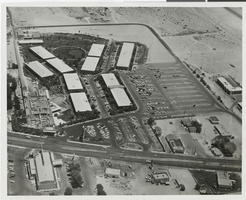
Aerial photograph of the Sands Hotel looking East (Las Vegas), early 1960s
Date
Archival Collection
Description
Aerial view of the Sands Hotel and adjacent property in the 1960s.
Site Name: Sands Hotel
Address: 3355 Las Vegas Boulevard South
Image
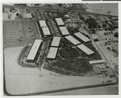
Aerial photograph of the Sands Hotel looking West (Las Vegas), early 1960s
Date
Archival Collection
Description
Aerial view of the Sands Hotel and adjacent property in the 1960s.
Site Name: Sands Hotel
Address: 3355 Las Vegas Boulevard South
Image
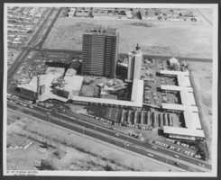
Aerial photograph of the Sahara Hotel, Las Vegas, Nevada, circa March 1963
Date
Archival Collection
Description
Image

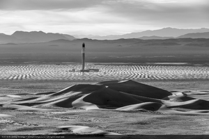
Aerial photo of Crescent Dunes Solar, near Tonopah, Nevada: digital photograph
Date
Archival Collection
Description
Photographer's assigned keywords: "110 megawatts; CSP; Concentrated Solar Energy; Concentrated Solar Power; Crescent Dunes; NV; Nevada; Solar Reserve; SolarReserve; Tonopah; aerial; concentrated solar thermal; green energy; molten salt; renewable energy; storage; tower."
Image