Search Results
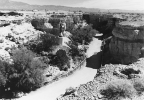
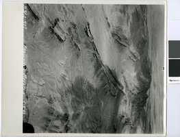
Aerial view of Cathedral Canyon: photographic print
Date
Archival Collection
Description
From the Nye County, Nevada Photograph Collection (PH-00221) -- Series IV. Pahrump, Nevada -- Subseries IV.D. Wiley Family.
Image

Aerial photograph of Twin Lakes, Lorenzi Park, Nevada, 1953
Date
Archival Collection
Description
Aerial view of Twin Lakes Resort.
Transcribed Notes: Written on back of photo: Twin Lakes about 1953 before subdivisions around property
Image
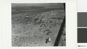
Aerial photograph of sewer seepage in Pittman, Nevada, April 16, 1945
Date
Archival Collection
Description
Aerial view of Pittman seepage
Image
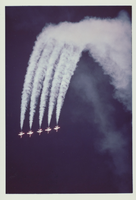
Photograph of five Thunderbirds planes performing aerial stunts, 1980
Date
Archival Collection
Description
Image
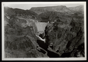
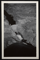
Aerial photograph of Hoover Dam, Colorado River, Black Canyon, circa 1935-1936
Date
Archival Collection
Description
Image
Aerial photograph of Frenchman Mountain looking southwest, May 4, 1949
Date
Archival Collection
Description
Aerial view of Frenchman Mountain, with the Las Vegas Valley behind it.
Transcribed Notes: Transcribed from handwritten notes on back: "View SW"
Image
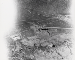
Aerial view of Carver's Station: photographic print
Date
Archival Collection
Description
From the Nye County, Nevada Photograph Collection (PH-00221) -- Series V. Smoky Valley, Nevada and Round Mountain, Nevada -- Subseries V.A. Carver, Carver-Duhme, and Carver-Book Families (Smoky Valley). The station itself is visible beside the road just above the trees. In those days most small airplanes landed on the highway, but some contractors were working in the area and one had a plane that was too large to land on the highway, so a small airstrip was constructed for landing, visible to the right of Carver’s Station.
Image

Aerial photograph of Las Vegas looking south, 1930
Date
Archival Collection
Description
Aerial view of Las Vegas in 1930.
Transcribed Notes: Notes on photo sleeve: 'Shows stockyards and car shops. Creek is overflow from UP artesian well. Site of earliest ranch in area. Creek had mosquito minnows in it - a native species. Only source of water for Las Vegas. Water carried in a 20-24'' wooden pipe.' (James J. Hester, from W.A. Davis, photographer. April 1992)
Image
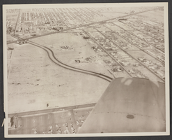
Aerial photograph of Civic Center Drive, North Las Vegas, January 18, 1966
Date
Archival Collection
Description
Image
Aerial photograph of Hoover Dam, Colorado River, Black Canyon, circa 1935-1936
Date
Archival Collection
Description
Image