Search Results
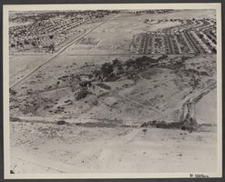
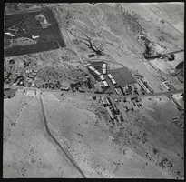
Aerial photograph of Kiel Ranch, North Las Vegas, circa 1974
Image
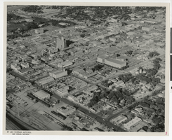
Aerial photograph of downtown Las Vegas, (Nev.), June 23, 1962
Image
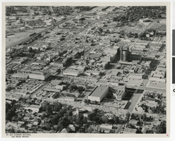
Aerial photograph of downtown Las Vegas, (Nev.), June 23,1962
Image
Slide of an aerial view of an unidentified city, Ohio, circa 1980-1990s
Image
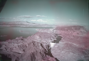
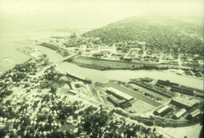
Film transparency of an aerial view of Hoover Dam, circa mid 1950s
Image
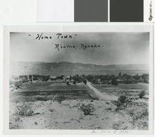
Aerial photograph of Alamo, Nevada, 1920-1925
Alamo, Nevada from an overlooking hill
Transcribed Notes: Transcribed from front of photo: "Home Town. Alamo, Nevada. In 1920 to 1925."; Transcribed from photo sleeve: "An aerial of Alamo, Nevada looking west in the early 1920s. The four room schoolhouse where Logan Wright attended in 1954 is in the center-back of the picture. Alamo Services was owned and operated by Larry and Evy Davis."
Image
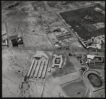
Aerial photograph of Las Vegas, Nevada: photographic print
Image
Aerial photograph of Las Vegas, Nevada: photographic print
Image
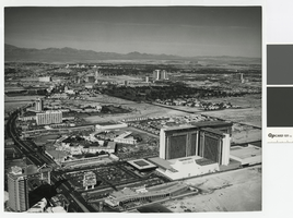
Aerial photograph of the Las Vegas Strip, circa 1975
Aerial view of Las Vegas Strip, looking north from MGM Grand Hotel and the Dunes.
Image
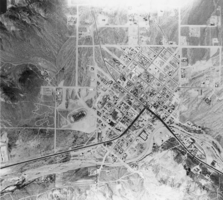
Aerial view of Beatty: photographic print
From the Nye County, Nevada Photograph Collection (PH-00221) -- Series III. Beatty, Nevada -- Subseries III.H. Miscellaneous
Image