Search Results
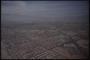
Color aerial view of Las Vegas.
Date
1950 to 1969
Description
Arrangement note: Series V. Glass slides
Image
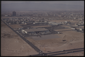
Color aerial view of Las Vegas.
Date
1950 to 1969
Description
Arrangement note: Series V. Glass slides
Image
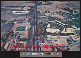
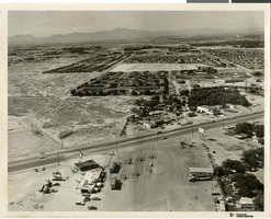
Postcard with aerial photograph of part of the Las Vegas Strip, 1960s
Date
1960 to 1969
Archival Collection
Description
Oversized postcard with aerial view of the Las Vegas Strip. Caption: "The fabulous Vegas Strip." On back: "P28950. Color by Stuart Griffith." Site Name: The Strip (Las Vegas, Nev.)
Image
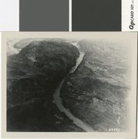
Aerial photograph taken of Black Canyon, before 1930
Date
open start to 1930
Archival Collection
Description
Aerial view of Black Canyon prior to the construction of Hoover Dam
Image
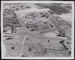
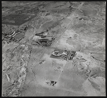
Photograph of an aerial view of Division I, Las Vegas (Nev.), January 22, 1947
Date
1947-01-22
Archival Collection
Description
Another aerial view of Division I in Las Vegas.
Image
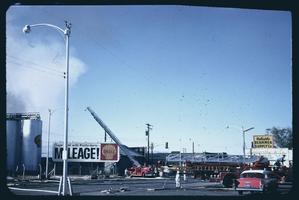
An aerial ladder truck preparing to fight a fire: photographic film
Date
1964
Archival Collection
Description
Two aerial ladder trucks are being moved into position to fight a fire near some Shell Oil storage tanks. A sign for the Reliable Bearing & Supply Co. is visible in the background. The Las Vegas Fire Department Battalion Chief's car is visible in the foreground.
Image
Aerial photograph of North Las Vegas, Nevada, June 5, 1973
Date
1973-06-05
Archival Collection
Description
Aerial view of North Las Vegas, Nevada, looking south from Las Vegas Boulevard North between North Pecos Road and Sandy Lane. Northland Gardens apartments are seen in the center of the photograph. Caption on back of photograph: "Project: Annex. area - land use. Location: Looking so. across, west on right L.V.B.N. toward Northland Gardens, Hol. Pk., Americana."
Image
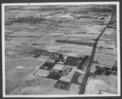
Aerial photograph of the University of Nevada, Las Vegas, Nevada, November, 1967
Date
1967-11
Archival Collection
Description
Aerial view of University of Nevada, Las Vegas, Nevada, November, 1967.
Image
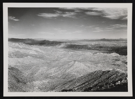
Aerial view near Nelson, Nev.: photographic print
Date
1932
Archival Collection
Description
Aerial view of desert landscape near Nelson, Nevada.
Image
Aerial photograph of Las Vegas, Nevada: photographic print
Date
1955
Archival Collection
Description
From the Mary and Arthur Ackerman Photograph Collection (PH-00306). The building on the west side of the Strip toward the right is the Dunes Hotel and Casino. In the center on the east side of the Strip is the Flamingo with the Sands Hotel and Casino to the north. The large tract of land in the upper left is the golf course of the Desert Inn.
Image