Search Results
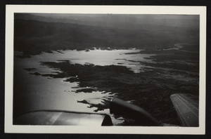
Photograph of an aerial view of Lake Mead, circa 1934-1939
Date
1934 to 1939
Archival Collection
Description
An image showing an aerial view of Lake Mead amidst its home of rocky terrain. Portions of the airplane from which the image was taken can be seen along the bottom border of the photograph.
Image
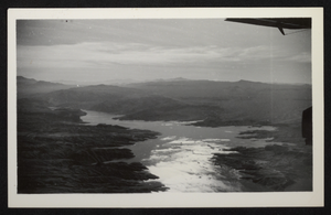
Photograph of an aerial view of Lake Mead, circa 1934-1939
Date
1934 to 1939
Archival Collection
Description
An image showing an aerial view of Lake Mead amidst its home of rocky terrain. Portions of the airplane from which the image was taken can be seen along the right border of the photograph.
Image
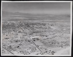
Photograph of an aerial view of Las Vegas (Nev.), January 22, 1947
Date
1947-01-22
Archival Collection
Description
An aerial view of Las Vegas with the display of a major street in center is U.S. Highway 91, now known today as Las Vegas Boulevard.
Image
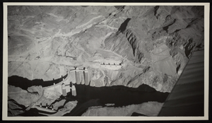
Aerial photograph of Hoover Dam, Black Canyon, circa 1934-1935
Date
1934 to 1935
Archival Collection
Description
Aerial view of Hoover Dam.
Image

Aerial photograph of Hoover Dam, Black Canyon, circa 1934-1935
Date
1934 to 1935
Archival Collection
Description
Aerial view of Hoover Dam.
Image
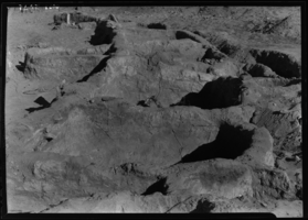
Film transparency of an aerial view of Valley of Fire, Nevada, circa 1930s
Date
1930 to 1939
Archival Collection
Description
Aerial view of Valley of Fire State Park printed on nitrate film.
Image

Photograph of an aerial view of I-15 construction, Las Vegas, June 5, 1973
Date
1973-06-05
Archival Collection
Description
An aerial view of the I-15 construction at Carey Avenue looking south towards Las Vegas.
Image
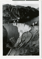
Aerial photograph of Hoover Dam and Lake Mead, 1935-1936
Date
1935 to 1936
Archival Collection
Description
Aerial view of Hoover Dam and Lake Mead in Black Canyon, taken from the dam's downstream side. The intake towers and electric power transmission towers are seen. Typed label on back of photograph: "Down-stream face - Boulder Dam."
Image
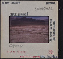
Photographic slide of Tule Springs aerial view, November 30, 1962
Date
1962-11-30
Archival Collection
Description
An aerial view of Tule Springs. "Camp" is written on the slide.
Image
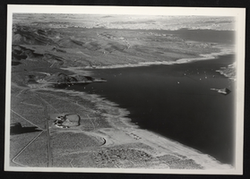
Photograph of an aerial view of Lake Mead, circa 1934-1939
Date
1934 to 1939
Archival Collection
Description
An image showing an aerial view of Lake Mead amidst its home of rocky terrain. Boats are scattered across the reservoir's surface as buildings dot the surrounding land.
Image