Search Results
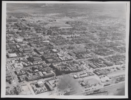
Photograph of an aerial view of Las Vegas (Nev.), January 22, 1947
Date
1947-01-22
Archival Collection
Description
An aerial view of Las Vegas showing most of downtown Las Vegas.
Image
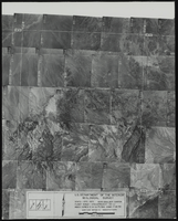
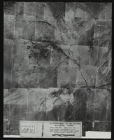
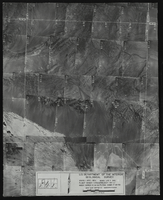
Aerial view of the Boulder Canyon quadrant in Arizona-Nevada: photographic print
Date
1950
Archival Collection
Description
From the Army Mapping Service Aerial Photographs of Southern and Western Nevada (PH-00285). Aerial photographs, composites, and indices. High altitude aerial photographs, Quad. Boulder Canyon, State: Arizona - Nevada. U.S. Geological Survey, Army Map Service. Flight Scale I-47200Project-GS-LJ. Index copied -8-26-50. Flying Comp. -7-26-50
Image
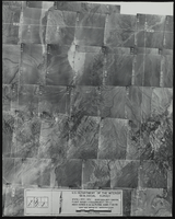
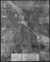
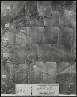
Aerial view of the Las Vegas quadrant in Arizona-Nevada: photographic print
Date
1950
Archival Collection
Description
From the Army Mapping Service Aerial Photographs of Southern and Western Nevada (PH-00285). Aerial photographs, composites, and indices. High altitude aerial photographs, Quad. Las Vegas 2. State: Arizona - Nevada. U.S. Geologial Survey, Army Map Service. Flight Scale I-47200Project-GS-LJ. Index copied -8-26-50. Flying Comp. -7-26-50
Image
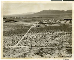
Aerial photograph of North Las Vegas, Nevada, June 5, 1973
Date
1973-06-05
Archival Collection
Description
Aerial view of North Las Vegas, Nevada. Handwritten on back of photograph: "Nellis Blvd. looking east."
Image
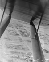
Film transparency of an aerial view, Las Vegas, 1929-1930
Date
1929 to 1930
Archival Collection
Description
An aerial view of Las Vegas as seen from inside an airplane.
Image
Aerial view of the Las Vegas quadrant in Arizona-Nevada: photographic print
Date
1950
Archival Collection
Description
From the Army Mapping Service Aerial Photographs of Southern and Western Nevada (PH-00285). Aerial photographs, composites, and indices. High altitude aerial photographs, Quad. Las Vegas 4. State: Arizona - Nevada. U.S. Geologial Survey, Army Map Service. Flight Scale I-47200Project-GS-LJ. Index copied -8-26-50. Flying Comp. -7-26-50
Image
Aerial view of the Las Vegas quadrant in Arizona-Nevada: photographic print
Date
1950
Archival Collection
Description
From the Army Mapping Service Aerial Photographs of Southern and Western Nevada (PH-00285). Aerial photographs, composites, and indices. High altitude aerial photographs, Quad. Las Vegas 3. State: Arizona - Nevada. U.S. Geologial Survey, Army Map Service. Flight Scale I-47200Project-GS-LJ. Index copied -8-26-50. Flying Comp. -7-26-50
Image
Aerial view of the Las Vegas quadrant in Arizona-Nevada: photographic print
Date
1950
Archival Collection
Description
From the Army Mapping Service Aerial Photographs of Southern and Western Nevada (PH-00285). Aerial photographs, composites, and indices. High altitude aerial photographs, Quad. Las Vegas 1. State: Arizona - Nevada. U.S. Geologial Survey, Army Map Service. Flight Scale I-47200Project-GS-LJ. Index copied -8-26-50. Flying Comp. -7-26-50
Image
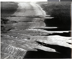
Aerial photograph of Lake Mead, 1940s-1950s
Date
1940 to 1959
Archival Collection
Description
Aerial photo of Lake Mead. Towards the bottom center of the photo, cars and boats can be seen.
Image