Search Results
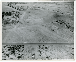
Aerial photograph of North Las Vegas, Nevada, June 5, 1973
Date
1973-06-05
Archival Collection
Description
Aerial view of housing developments in North Las Vegas, Nevada. Handwritten on back of photograph: "Losee at Kyle Ranch, looking n.w."
Image
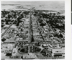
Aerial photograph of downtown Las Vegas, circa 1950
Date
1950 to 1959
Archival Collection
Description
Aerial view of downtown Las Vegas in the early 1950s. The Union Pacific Depot is in the center foreground. Las Vegas High School is shown at the right, with large areas of undeveloped land behind it. Physical object has an insert containing additional biographical information.
Image
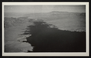
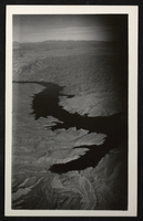
Photograph of an aerial view of Lake Mead, circa 1934-1939
Date
1934 to 1939
Archival Collection
Description
An image showing an aerial view of Lake Mead amidst its home of rocky terrain.
Image
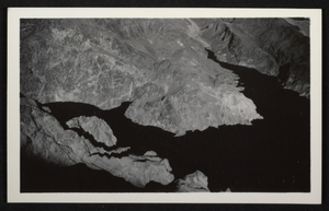
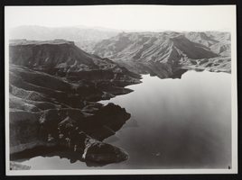
Photograph of an aerial view of Lake Mead, circa 1934-1939
Date
1934 to 1939
Archival Collection
Description
An image showing an aerial view of Lake Mead amidst its home of rocky terrain.
Image
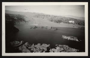
Photograph of an aerial view of Lake Mead, circa 1934-1939
Date
1934 to 1939
Archival Collection
Description
An image showing an aerial view of Lake Mead amidst its home of rocky terrain.
Image
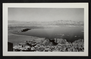
Photograph of an aerial view of Lake Mead, circa 1934-1939
Date
1934 to 1939
Archival Collection
Description
An image showing an aerial view of Lake Mead amidst its home of rocky terrain.
Image
Photograph of an aerial view of Lake Mead, circa 1934-1950s
Date
1934 to 1959
Archival Collection
Description
An image showing an aerial view of Lake Mead amidst its home of rocky terrain.
Image
Photograph of an aerial view of Lake Mead, circa 1934-1950s
Date
1934 to 1959
Archival Collection
Description
An image showing an aerial view of Lake Mead amidst its home of rocky terrain.
Image
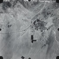
Aerial film transparency of Boulder City, Nevada, August 18, 1974
Date
1974-08-18
Archival Collection
Description
Aerial view of Boulder City, Nevada, August 18, 1974.
Image
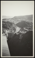
Aerial photograph of Hoover Dam, Black Canyon, circa 1934-1935
Date
1934 to 1935
Archival Collection
Description
Aerial view of Hoover Dam.
Image