Search Results
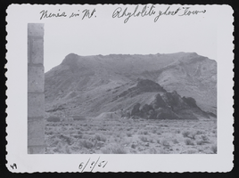
Rhyolite (Nev.), image 001: photographic print
Date
1951
Archival Collection
Description
Rhyolite ghost town. Mines are visible in the mountains. (1951)
Image
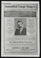
Mining Advertisment for Diamondfield Triangle Mining Co.: photographic print
Date
1905 (year approximate)
Archival Collection
Description
Advertisement for Diamondfield Triangle Mining Co., Diamondfield, Nevada. The news clipping includes photo of "Diamondfield Jack" Davis, founder and locator of the mining district circa 1905.
Image
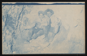
Two men in a mine: photographic print
Date
1900 (year approximate) to 1915 (year approximate)
Archival Collection
Description
Two men in a mine; Rinker is on the right.
Image
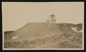
Unidentified mining location, image 001: photographic print
Date
1907 (year approximate) to 1908 (year approximate)
Archival Collection
Description
An unidentified mining location, in or near Goldfield, Nevada. Possibly part of the Mohawk Lodge Mine.
Image
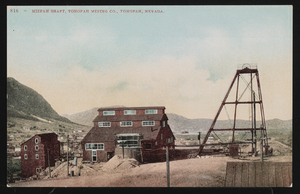
Mizpah Mine shaft: postcard
Date
1900 (year approximate) to 1915 (year approximate)
Archival Collection
Description
Tinted postcard of the Mizpah Mine shaft of the Tonopah Mining Company.
Image
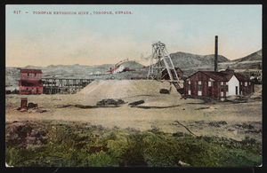
The Tonopah Extension Mine: postcard
Date
1900 (year approximate) to 1915 (year approximate)
Archival Collection
Description
Postcard of the Tonopah Extension Mine.
Image
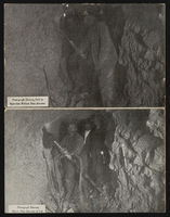
Miners with and without Dust Arrester: postcard
Date
1900 (year approximate) to 1915 (year approximate)
Archival Collection
Description
Postcard images showing miners working with and without the "Dust Arrester." Possibly an advertisement for product?
Image

Three Kids Manganese Mine: photographic print
Date
Unknown year in the decade of the 1950s (year approximate)
Archival Collection
Description
Three Kids Manganese Mine, ca. 1950's.
Image

Manganese Incorporated: photographic print
Date
Unknown year in the decade of the 1950s (year approximate)
Archival Collection
Description
Manganese Inc. (Operated Three Kids Mine) [c. 1950's]
Image
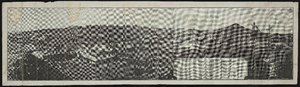
Panoramic view of Mohawk Mine, Goldfield, Nevada: photographic print
Date
1906
Archival Collection
Description
From the Nevada Mining Photograph Collection (PH-00361).
Image