Search Results
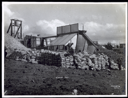
Photograph of workers piling sacks of ore from the Jumbo Mine, Goldfield (Nev.), early 1900s
Archival Collection
Description
Caption: Jumbo Ore
Image
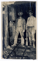
Photograph of two men standing on ore car rails inside a mine, Goldfield (Nev.), 1907
Date
1907
Archival Collection
Description
Photograph of two men standing on ore car rails inside a mine, Goldfield (Nev.), 1907
Image
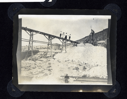
Photograph of men and women standing on ore cart trestle, Round Mountain (Nev.), early 1900s
Date
1900 to 1925
Archival Collection
Description
Photograph of men and women standing on ore cart trestle, Round Mountain (Nev.), early 1900s
Image
Photograph of men moving sacked ore at mine, Round Mountain (Nev.), early 1900s
Date
1900 to 1925
Archival Collection
Description
Photograph of men moving sacked ore at mine, Round Mountain (Nev.), early 1900s
Image
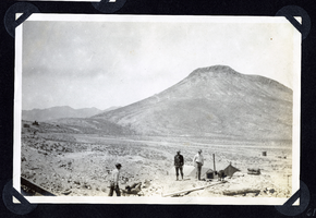
Photograph of crowd watching men compete in hand drilling contest, Round Mountain (Nev.), early 1900s
Date
1900 to 1925
Archival Collection
Description
Photograph of crowd watching men compete in hand drilling contest, Round Mountain (Nev.), early 1900s
Image

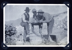
Photograph of men with sacks of ore from Round Mountain (Nev.), early 1900s
Date
1900 to 1925
Archival Collection
Description
Photograph of men with sacks of ore from Round Mountain (Nev.), early 1900s
Image

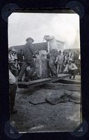
Photograph of men building mine headframe, Round Mountain (Nev.), early 1900s
Date
1900 to 1925
Archival Collection
Description
Photograph of men building mine headframe, Round Mountain (Nev.), early 1900s
Image
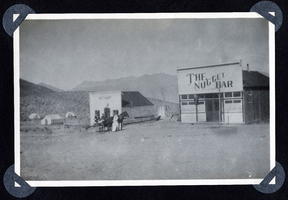
Photograph of a buggy in front of butcher shop in Round Mountain (Nev.), early 1900s
Date
1900 to 1925
Archival Collection
Description
Photo shows the Nugget Bar and Meat Market in Round Mountain.
Site Name: The Nugget Bar (Round Mountain, Nev.)
Site Name: The Nugget Bar (Round Mountain, Nev.)
Image
Photograph of men posing with gold pan, Round Mountain (Nev.), early 1900s
Date
1900 to 1925
Archival Collection
Description
Photograph of men posing with gold pan, Round Mountain (Nev.), early 1900s
Image

Photograph of men at mine site under headframe, Round Mountain (Nev.), early 1900s
Date
1900 to 1925
Archival Collection
Description
Photograph of men at mine site under headframe, Round Mountain (Nev.), early 1900s
Image