Search Results
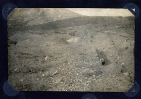
Photograph of mine area and scattered debris, Round Mountain (Nev.), early 1900s
Date
1900 to 1925
Archival Collection
Description
Photograph of mine area and scattered debris, Round Mountain (Nev.), early 1900s
Image
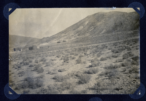
Photograph of Round Mountain hillside (Nev.), early 1900s
Date
1900 to 1925
Archival Collection
Description
Photograph of Round Mountain hillside (Nev.), early 1900s
Image

Photograph of mining operations, Goldfield (Nev.), early 1900s
Archival Collection
Description
Caption: Mines
Image
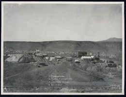
Photograph of mining operations, Goldfield (Nev.), early 1900s
Archival Collection
Description
Caption: Key reads: 1 Combination, 2 Mill Foundations, 3 January Lease, 4 Goldfield
Image
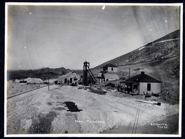
Photograph of Montana Tonopah Mine and outbuildings, Tonopah (Nev.), early 1990s
Archival Collection
Description
Caption: Mon. Tonopah
Image
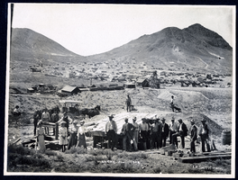
Photograph of group of people posing at Montana Tonopah Mine, Tonopah (Nev.), 1902
Date
1902
Archival Collection
Description
Caption: Lucky Jim 1902
Image

Photograph of January Lease mine, Goldfield (Nev.), 1904
Date
1904
Archival Collection
Description
[The January was the third mine to open in 1904]
Caption: January Lease
Caption: January Lease
Image
Photograph of men working at mining claim, Goldfield (Nev.), early 1900s
Archival Collection
Description
Caption: January Claim Goldfield, Nev.
Image
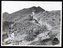
Photograph of ledge at Valley View Hill, Goldfield (Nev.), early 1900s
Archival Collection
Description
Caption: Valley view ledge
Image

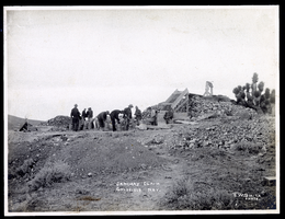
Photograph of men loading ore at Sandstorm Mine, Esmeralda (Nev.), early 1900s
Archival Collection
Description
Caption: Sandstorm Loading Ore
Image