Search Results
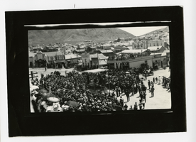
Photograph of a crowd watching the Labor Day drilling contest, Tonopah (Nev.), 1906
Date
1906
Archival Collection
Description
Photograph of a crowd watching the Labor Day drilling contest, Tonopah (Nev.), 1906
Image
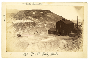
Photograph of Mt. Diablo Hoisting Works, Candelaria (Nev.)
Date
1880 to 1915
Archival Collection
Description
Mt. Diablo Hoisting Works in foreground; Metallic Equator Hoisting Works, far left, Northern Belle Hill in background.
Image
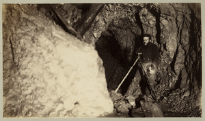
Photograph of the Underground mining surveyor James B. Cross, Candelaria (Nev.), 1900-1925
Date
1900 to 1925
Archival Collection
Description
Photograph of the Underground mining surveyor James B. Cross, Candelaria (Nev.), 1900-1925
Image
Photograph of hillside Delamar Mill, Delamar Mountains (Nev.), early 1900s
Date
1900 to 1925
Archival Collection
Description
Photograph of hillside Delamar Mill, Delamar Mountains (Nev.), early 1900s
Image
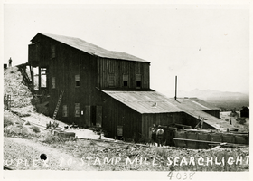
Photograph of duplex ten stamp mill, Searchlight (Nev.), early 1900s
Date
1900 to 1925
Archival Collection
Description
Photograph of duplex ten stamp mill, Searchlight (Nev.), early 1900s
Image

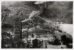
Photograph of the Belmont Mine, Tonopah (Nev.), 1900-1925
Archival Collection
Description
Caption: Tonopah Belmont Mines (Nev.)
Image
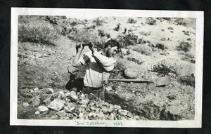
Photograph of Jim Salisbury digging a trench, Eldorado Canyon (Nev.), 1907
Date
1907
Archival Collection
Description
Transcription on front reads "Jim" Salisbury 1907
Image
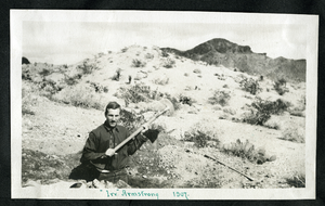
Photograph of Irv Armstrong digging a trench in the desert, Eldorado Canyon, Nelson (Nev.), 1907
Date
1907
Archival Collection
Description
Inscription on front reads: "Irv" Armstrong 1907
Image
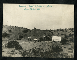
Photograph of the Silver Shield Mine, Knob Hill (Nev.), 1906
Date
1906
Archival Collection
Description
Caption: Silver Shield Mine 1906, Nob Hill, Nev.
Image
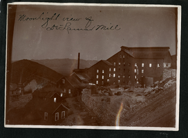
Photograph of night operations at the Delamar Mill, Delamar (Nev.), 1900-1925
Archival Collection
Description
Caption: Moonlight view at Delamar Mill
Site Name: Delamar Mill (Delamar, Nev.)
Site Name: Delamar Mill (Delamar, Nev.)
Image